Columbia
History of the Area
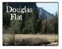
California Historical Landmark number 272 states: “Douglas Flat was a roaring mining camp of the early 1850s. In 1857 the Harper and Lone Star Claims produced $130,000 worth of gold. The so-called Central Hill Channel, an ancient river deposit from which vast quantities of gold have been taken, is located here.”
Nearby Moaning Caverns were known to the Miwok tribe long before the gold rush. They had a legend about three maidens seeking husbands and an old and wise woman who advised them to go into Samwel Cave. One of the maidens fell down a shaft but the Miwok tribe was afraid of caves, so nobody went to look for the girl.
Some of the oldest human remains known in America were discovered in Moaning Cavern preserved by the mineral-rich water in the cave. Archeologists found a girl’s skelton at the bottom of a drop, knowing the Miwok legend they returned the 200 year old bones to the tribe. For more information see the Caverns and Spelunking in the Mother Lode page in the destination section.
Douglas Flat Zip Code: 95229
Related Links
Events
Aronos Research Club | 10:00 am - 1:00 pm
Flag Raising Ceremony at the Buena Vista Cemetery in Murphys
Buena Vista Cemetery | 1:00 pm - 1:30 pm

 Mother Lode Fair Exhibits To Honor Local Veterans, Community Leaders
 Multi-Agency Help For TCU September Lightning Complex Victims
 No Special Reservations Required This Year For Horsetail Fall In Yosemite
