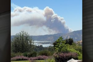
Update at 6:15 p.m.: The Aero Fire acreage is holding at 5,351 acres, and the containment has increased to 58%. Three structures have been destroyed and one damaged, with 542 structures threatened. Resources on scene include 129 engines, 21 water tenders, 5 helicopters, 36 dozers, 11 hand crews, and 146 others, for a total of 1,014 personnel. An update on evacuation changes and road closures is below.
Update at 2:10 p.m.: CAL Fire TCU has released the latest round of lifted Aero Fire evacuations and repopulation information:
- Evacuation Warnings: CCU -147-C, CCU -147-E, CCU – 152-C, CCU -152-D, CCU-152-E , CCU -153-A , CCU -156-C , CCU-157-B, CCU-168-C
- Evacuation Orders: cc U – 147-F, CCU – 152-B, CCU – 153-B, CCU – 156-B, CCU – 157-A, CCU -168-B
- Click here to view the latest map.
Road Closures: Pyle Rd. at O’Byrnes Ferry Rd., Rock Creek at Highway 4, Britchen Dr., and Rock Creek at the fire perimeter line.
For those switching from an evacuation order to a warning, fire officials ask that you continue to follow fire updates, as current conditions can change. There will continue to be a strong public safety presence in the repopulated and evacuated areas for the next several days, with crews on hand to ensure the protection of residents and their property.
“We will continue to monitor the active fire areas, as well as those areas remaining closed due to critical infrastructure concerns or safety hazards,” stated CAL Fire TCU officials.
It can be difficult to come home after a wildfire. When a wildfire burns through an evacuated area, many things are taken into consideration before allowing residents to return. Fire-weakened trees, brush, power lines, and utility poles will need to be cleared. Also, crews will continue to check for gas leaks and any burning hazardous material that may need attention before allowing residents to return.
Fire officials note, “Be aware there may be traffic flow interruptions due to fire crews and utility workers still operating in the area, and PG&E is working diligently to restore power to the affected areas.”
Make sure to click on the video in the image box to see firefighters in action battling the Aero Fire.
Update written by BJ Hansen at 7:17 am: CAL Fire updates this morning that the Aero Fire is now 52% contained and holding at 5,351 acres.
The incident command team adds, “Large fuels and stump holes continue to hold heat and smolder within the fire perimeter. Overnight, firefighters constructed additional fire line and reinforced the existing fireline with mop-up. These efforts will continue today. Temperatures are expected to increase into the low 90s with relative humidities in the low twenties today. The fire area will experience a continual warming with high temperatures through the weekend. Fire suppression repair is occurring to minimize surface erosion and protect watersheds and habitats. Damage Inspections will continue today and the information will be made available when completed.”
Original story posted at 6:13 am: Copperopolis, CA — The Aero Fire in Copperopolis is holding at 5,351 acres and there is 45% containment.
All of the earlier evacuation warnings have been lifted for both Tuolumne and Calaveras counties, but there are still some evacuation orders in place for parts of Copperopolis. Click here to view the latest map.
Initially, 3,600 structures were threatened, and CAL Fire updates that the number is now reduced to 542. The agency is also updating that two structures have been destroyed and two more have been damaged.
The incident command team reports that fire behavior was minimal on Wednesday with “most activity observed in islands of unburned vegetation that are burning and smoldering. Firefighters continued fire line construction, strengthening of established lines, and mop-up of heat pockets along the perimeter.”
Evacuation shelters are still open at the Mark Twain Elementary School and the Valley Springs Veterans Hall. Animal evacuation shelters are at the Calaveras County Fairgrounds and the Valley Springs Veterans Hall.
Copperopolis area residents are asked to temporarily conserve water.
Road closures still in effect:
Pyle Rd. at O’Byrnes Ferry Rd, Rock Creek at Highway 4, Britchen Dr. at the Fire perimeter line, Rock Creek at the fire perimeter line.
1,014 firefighters are assigned to the incident, 129 engines, 21 water tenders, 36 dozers and five helicopters.


