
Yosemite, CA – Three fires continue to burn in Yosemite National Park.
The most recent blaze, the Aspen Fire, which is burning within the Rim Fire footprint, east of Aspen Valley, has grown to 26 acres. Crews have achieved 30% containment. The wildfire ignited on Sunday afternoon, and its cause remains under investigation.
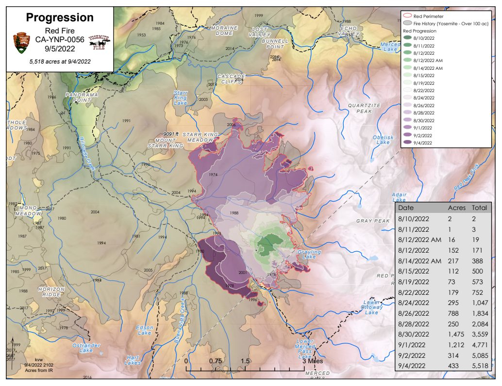
Crews continue to work on two lightning-strike fires that were sparked at the beginning of August. The Red Fire has climbed to 6,056 acres. Park fire officials relay, “Crews continue assessing natural barriers, like granite, to confine and contain the fire. There are no immediate threats to structures or critical infrastructure.” There are currently 40 firefighters on the scene.
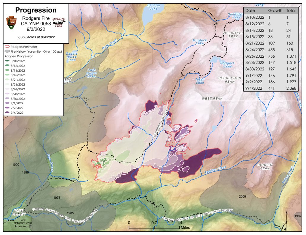
The Rodgers Fire has inched up to 2,541 acres and is burning in the high country of the Yosemite wilderness. There are 106 firefighters currently working on the blaze.
According to park officials, the Red Fire is 15% complete and the Rodgers Fire is 20% complete “due to the cessation of fire spread due to natural barriers.” Both fires are being managed by a Type 3 organization. Below are the latest updates on these blazes provided by park officials:
ASPEN FIRE:
Location: Northeast of Aspen Valley
Elevation: 6,200
Discover date: September 4, 2022
Size: 26 acres
Cause: under investigation
Being fully suppressed
Fire History: Burning in the 2013 Rim fire footprint
Burning in snags and whitethorn
No closures, no evacuations
RED FIRE:
Location: Between Red Creek and Illilouette Creek
Elevation: 7,800
Discover date: August 4, 2022
Size: 6,056 acres
Cause: Lightning
Fire History: Burning in the 2001 Hoover fire footprint
Burning in red fir, lodge pole litter. Most activity on the southwest
Trail closures on segments heading out the Illilouette drainage from Glacier Point area to Merced Pass Lake is temporarily closed due to fire activity
RODGERS FIRE:
Location: Northwest of Rodgers Canyon and southwest of Pleasant Valley
Elevation: 8,100
Discover date: August 8, 2022
Size: 2,541 acres
Cause: Lightning
No recent fire history
Burning in mixed conifer and red fir litter, and dead and down logs. Activity is on the north, southeast, and southwest corners
A segment of trail in Rodgers Canyon from Neall Lake to the junction with Table Lake is temporarily closed due to fire activity