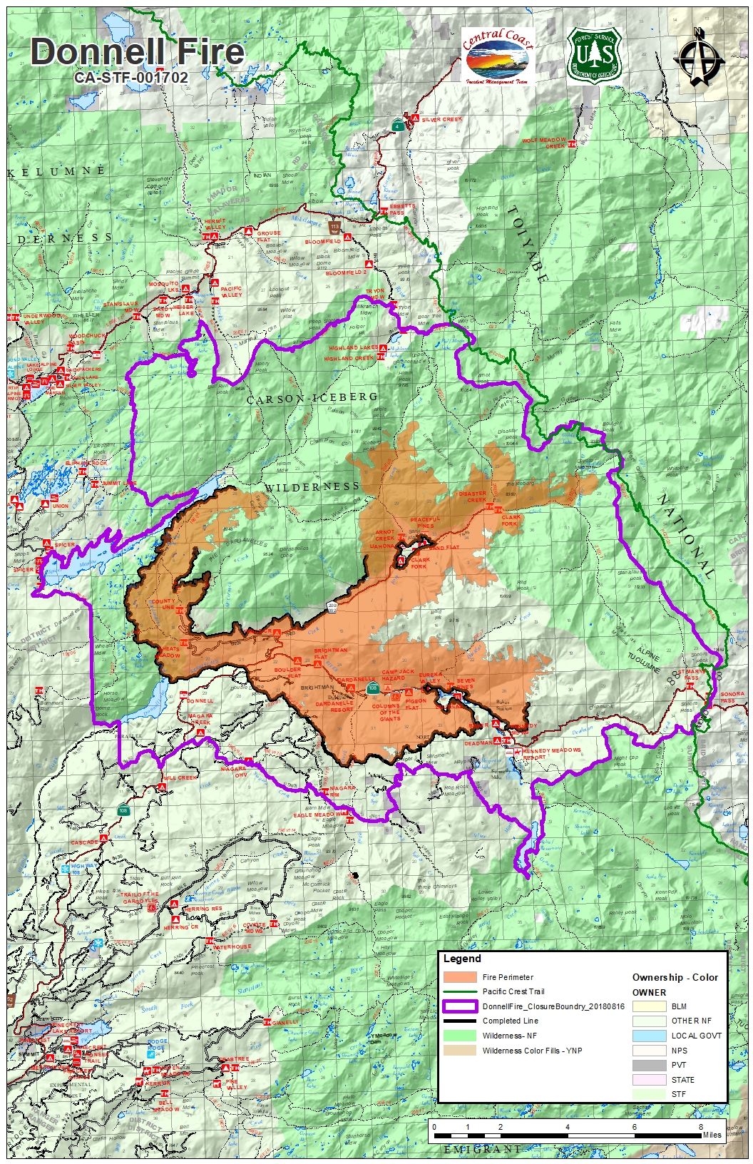
Tuolumne County, CA — Incident Command reports the Donnell Fire’s containment jumped to 62-percent overnight and the acreage increased just 288 acres for a total of 35,288.
Crews are continuing to get some help from natural barriers northeast of Spicer Reservoir where the flames remain very active. Incident spokesperson Bob Francis details that there is some concern that the fire may spread and impact the Pacific Crest Trail if winds continue to fuel the flames above Disaster and Boulder creek drainages in upper Clarks Fork.
Inspections began today by Tuolumne County Division of Environmental Health, which will give cabin owners a chance to survey the damage to properties. Inspectors are doing hazardous material screening of the burnt structures. Francis explains, “Once they [Environmental Health] complete all their damage assessment and they lift the mandatory evacuations, the Forest Service will then begin issuing the permits to the permittees to go back into their cabins at that time.”
Mandatory evacuations remain in effect along Highway 108 from Eagle Meadow Road to Kennedy Meadows while advisory evacuations are still in place in the Mill Creek area. U.S. Forest Service personnel and the Tuolumne County Sheriff’s Office are patrolling from Highway 108 through Highway 395. Motorists are also still prohibited from stopping on the highway from Eagle Meadow Road (5N01) to Sonora Pass.
Resources on scene continue to drop. There are 696 personnel, 15 hand crews, 7 helicopters, 25 engines, 6 water tenders. Additionally today, the Central Coast Incident Management Team will relinquish command of the blaze to the Summit Ranger District Type 3 Incident Management Team this evening at 6 p.m.