Update at 5:50 p.m.: While the Tiger Fire remains burning only in Amador County, an evacuation warning has been issued for parts of the West Point area of Calaveras County out of an abundance of caution. Calaveras County Sheriff’s Office advised, “In coordination with the CAL Fire incident commander and out of an abundance of caution, we are issuing an evacuation warning: The area affected includes Skull Flat Road from the intersection of Meadow View Road (including all of Meadow View), east on Skull Flat Road East to the intersection of Argonaut Road, including all of Argonaut Road, West Point.” Click here for the Genasys zone CCU-004 B.
The CAL Fire AEU Unit reports crews will continue working throughout the night to stop the Tiger Fire’s forward progress and improve containment. What ignited the Tiger Fire is under investigation. For more details, including Amador County evacuation and shelter locations, see below.
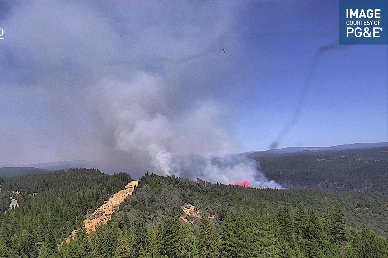
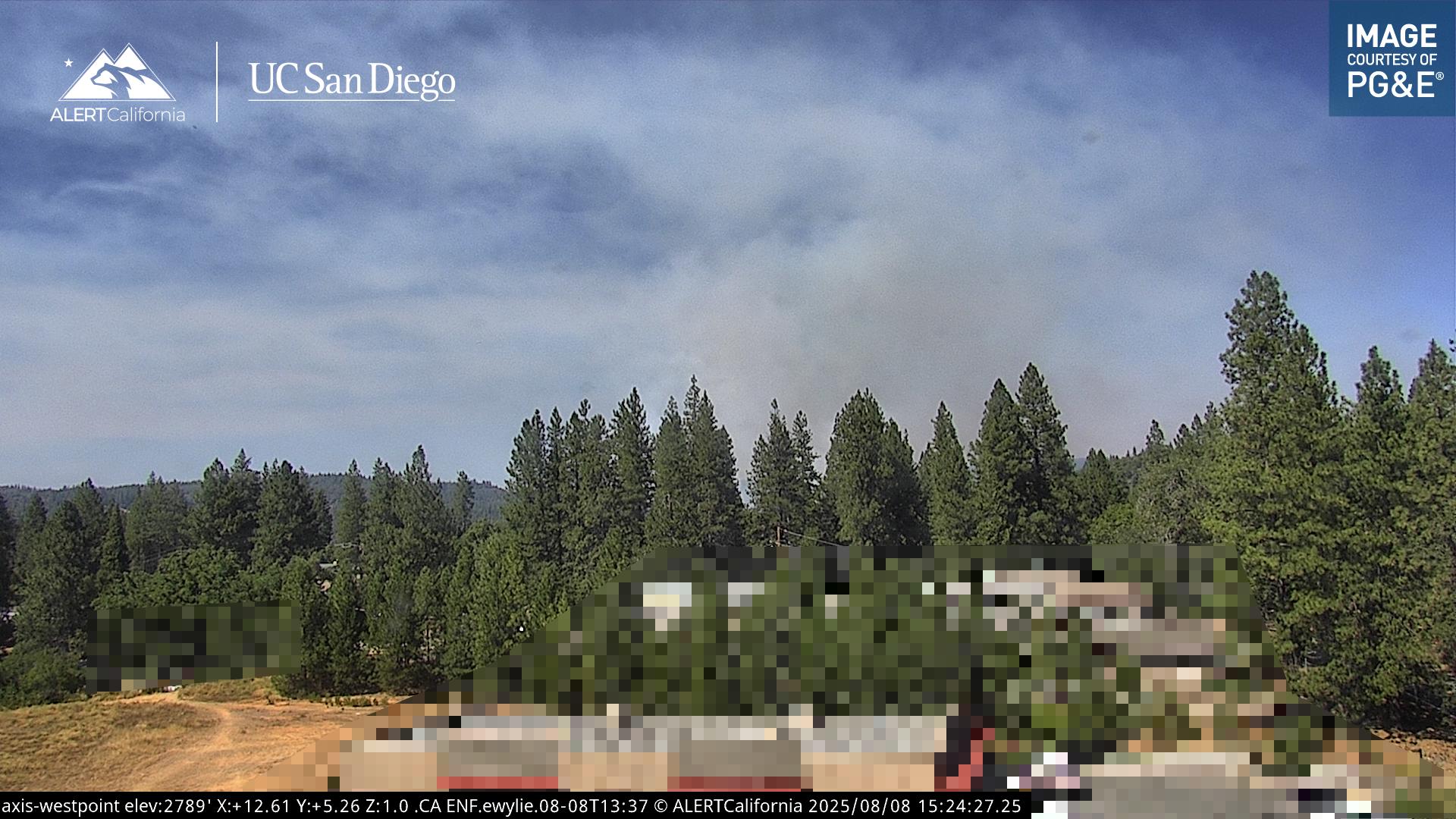
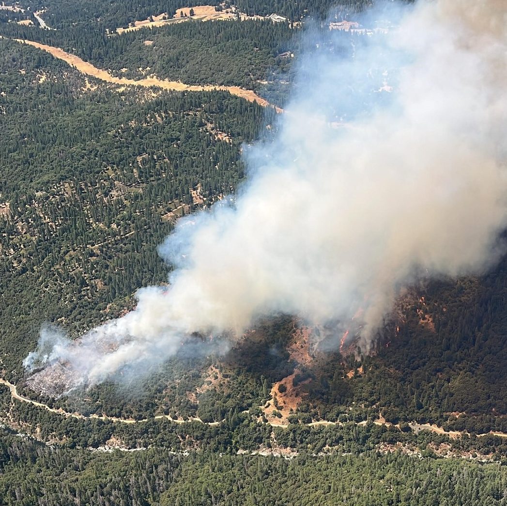
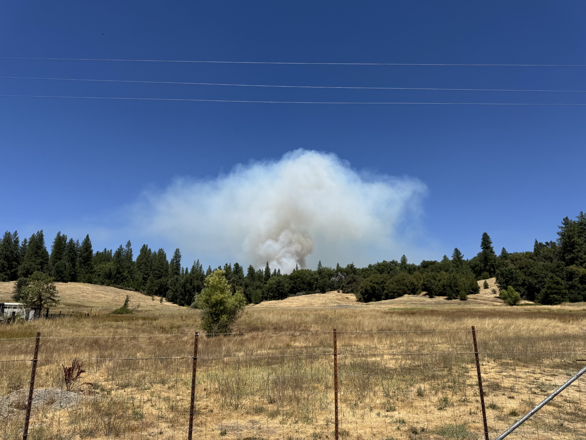
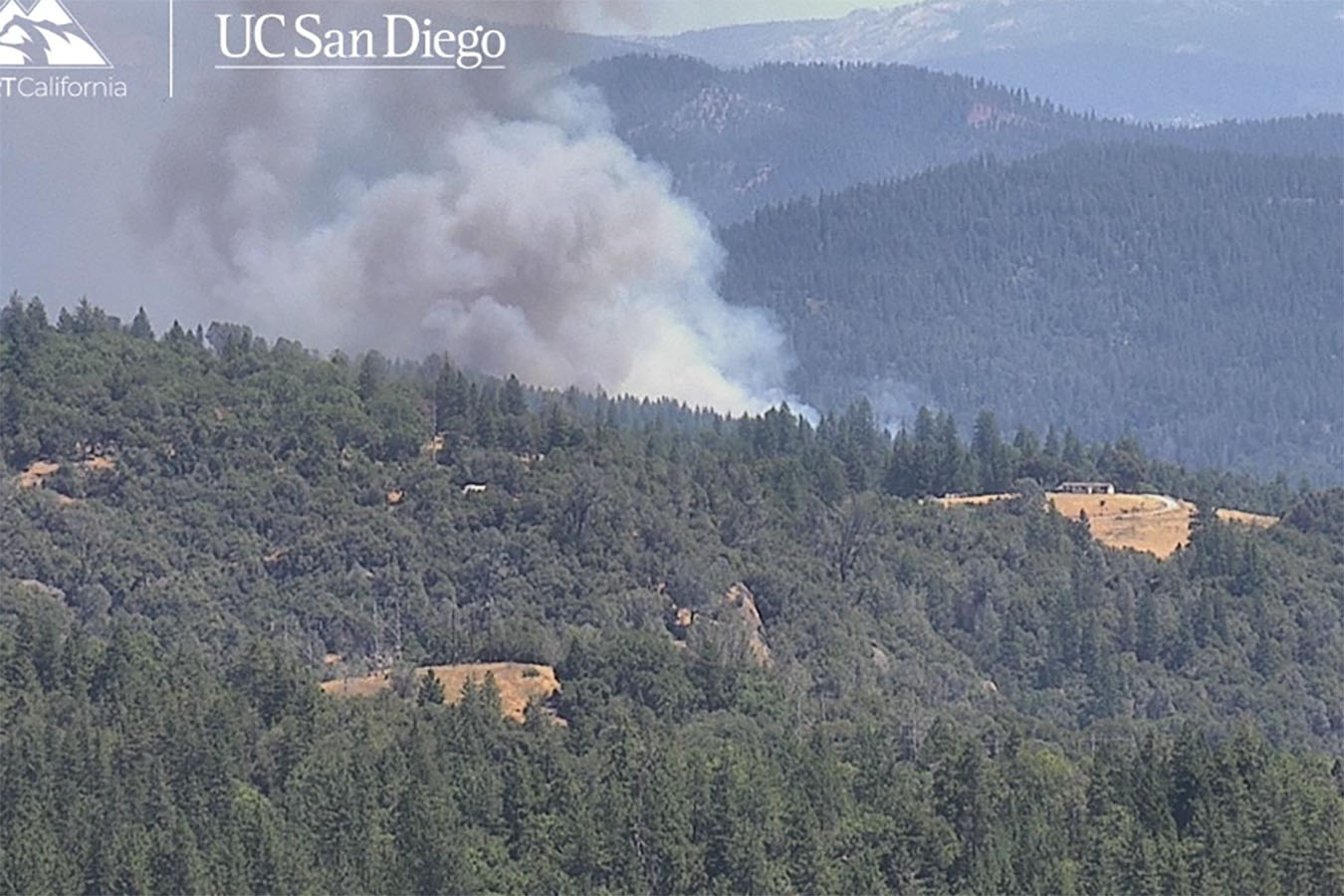
Update at 4:48 p.m.: CAL Fire AEU updates that crews are making progress on the Tiger Fire that ignited after one this afternoon in the 28000 block of Tiger Creek Road in the Pioneer area of Amador County off Highway 88 and close to the Calaveras County line near West Point. While the fire’s size remains 84 acres, crews have gained 5% containment. More than 200 firefighters continue battling the fire, and evacuation warnings and orders remain in place. Find more blaze details below.
Update at 4:10 p.m.: PG&E reports the power is out for 1,790 customers within and around the Tiger Fire area. Further details on the blaze can be viewed below.
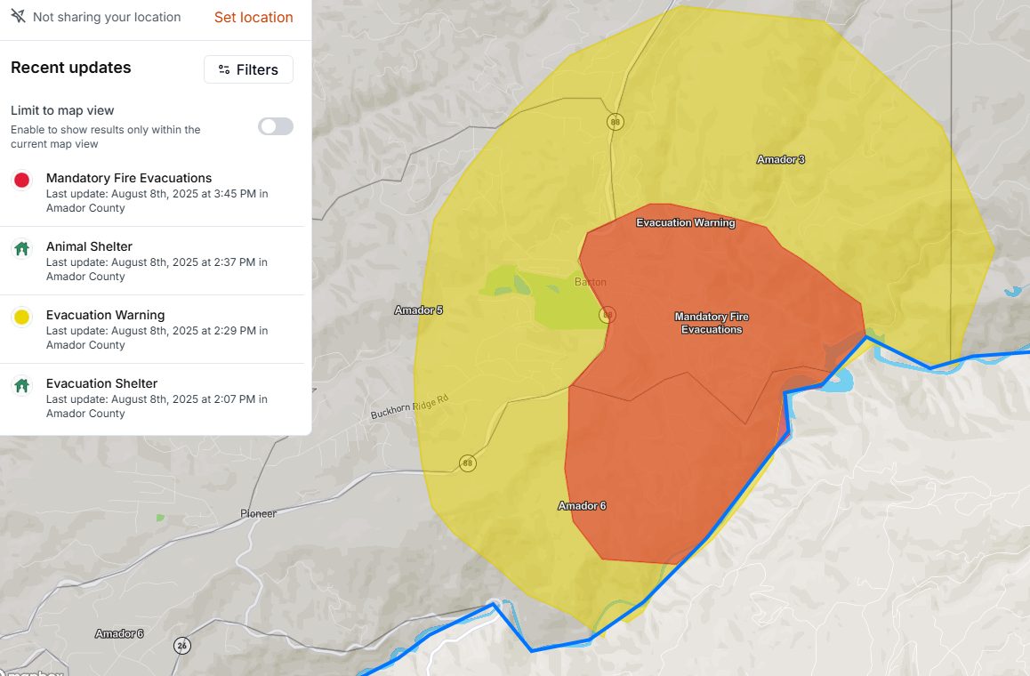
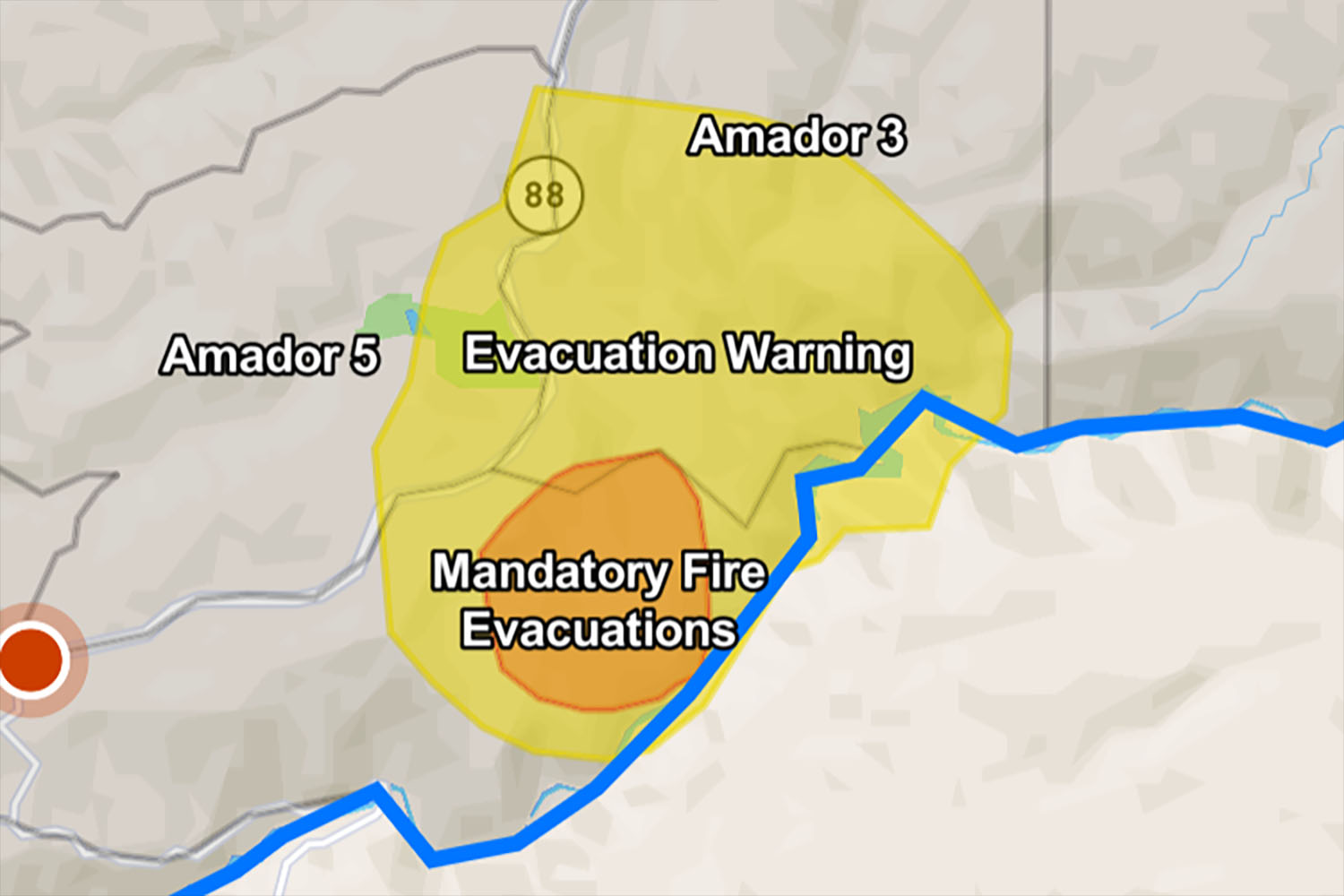
Update at 2:58 p.m.: Fire mapping has updated the Tiger fire’s size to 84 acres. The mandatory evacuation and advisory areas have expanded within the advisory area, as seen in this map. An animal shelter has been established at Laughton Ranch, 90 Clinton Road in Jackson. In addition, an evacuation center has been opened at the Amador Senior Center at 229 New York Ranch Road in Jackson.
Update at 2:50 p.m.: While evacuation orders and advisories have been issued in Amador County for the 50- to 60-acre Tiger Fire burning near Pioneer (see below) in Amador County, close to the Calaveras County line near West Point, Clarke Broadcasting checked with the Calaveras County Sheriff’s office regarding evacuations. Spokesperson Lt. Greg Stark stated, “We have no warnings or evacuation orders on our side of the river.”
Update at 2:15 p.m.: The CAL Fire AEU Unit reports that evacuation orders and advisories have been issued for the Tiger Fire burning in Amador County, close to the Calaveras County line near West Point. CAL Fire reports that the blaze is 40 to 50 acres in size and moving at a moderate rate of spread in a drainage area near Tiger Creek. The flames ignited in the 28000 block of Tiger Creek Road off Highway 88, with structures threatened.
Mandatory Evacuation Orders:
- Stephanie Way
- Tiger Creed Rd.
- Black Prince Rd. E.
- Black Prince Rd.
The Red Cross has set up an evacuation shelter at the Amador Senior Center at 229 New York Ranch Road in Jackson.
Original post at 1:23 p.m.: Pioneer, CA — Air and ground fire resources are working a vegetation fire, named the Tiger Fire, northeast of Pioneer in Amador County, close to the Calaveras County line near West Point.
CAL Fire reports that the blaze is 40 to 50 acres in size and moving at a moderate rate of spread in a drainage area near Tiger Creek. The flames ignited in the 28000 block of Tiger Creek Road off Highway 88. Currently, there are structures threatened. An update will be provided as soon as new information becomes available in the newsroom.