Beardsley Day Use Among Forest Roads Still Off Limits For Recreaters
Sonora, CA — A popular day use route and several other forest roads will remain closed for months, officials say, due to still unrepaired damage from past winter storms.
Stanislaus National Forest Supervisor Jason Kuiken signed an updated forest order (STF-16-2019-08), which lists forest areas closed due to ravages from 2016-17 winter storms. Officials anticipate this latest closure order will remain in effect — unless otherwise modified — until Dec. 31, 2020 due to public safety concerns and work scope still ahead.
“In January and February of 20l7, areas of the Stanislaus National Forest received heavy rain, snow and winds that resulted in significant road damage and fallen trees across the forest,” Kuiken explains. “While the damage to many roads and areas has been repaired, one area and several roads have not yet been fixed.”
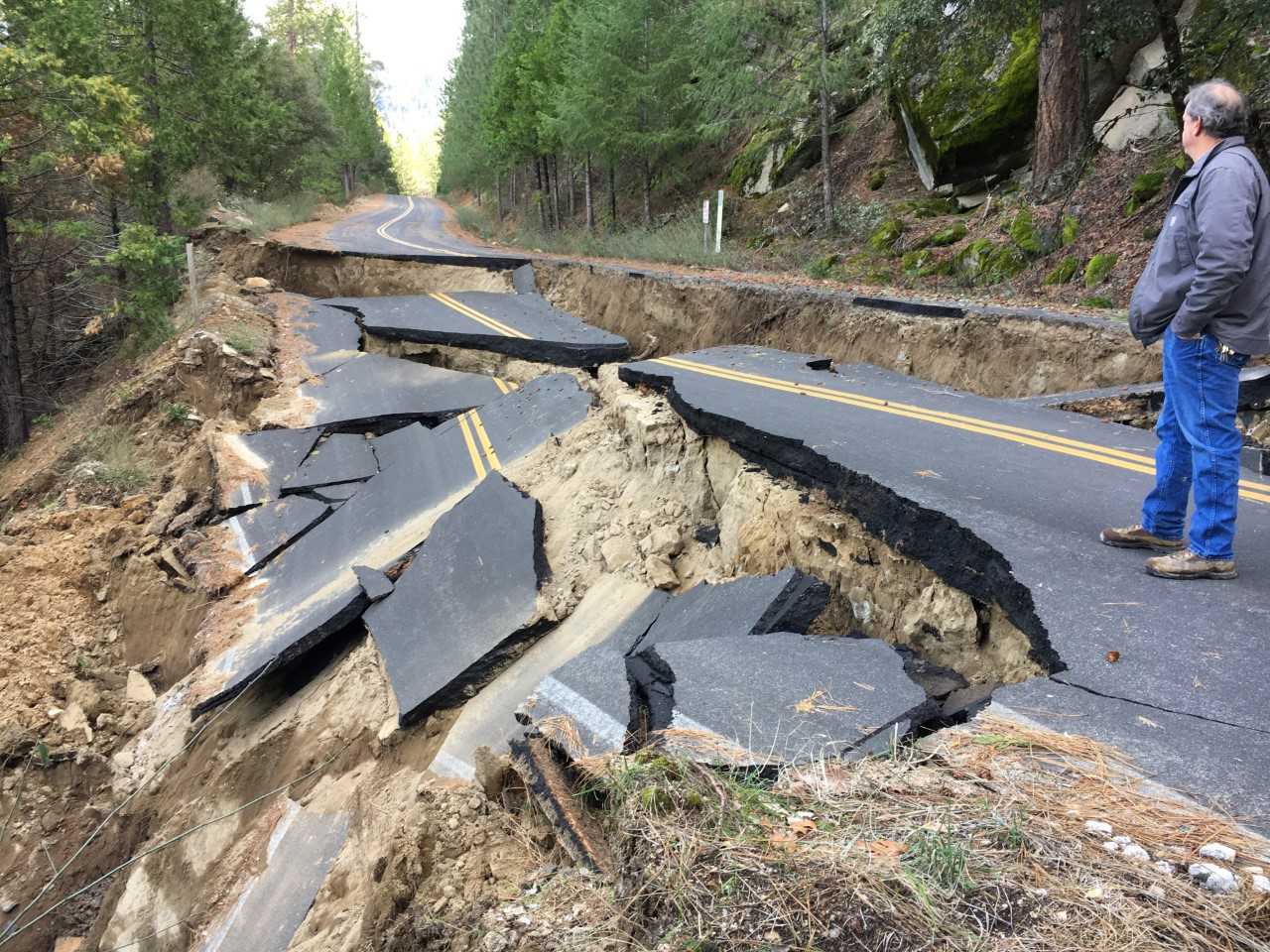
Many of the closed roads suffered extensive damage, including complete washouts and roadbed failures. Forest Engineer Tim Hughes shares, “For example, due to the complexity of the failure on the Beardsley Day Use Road, it qualified under the Federal Highway Administration’s Emergency Relief for Federal Roads program.”
Hughes adds that the Forest Service has contracted with a civil engineering firm that will perform a site survey and geotechnical investigation to determine the magnitude of the road failure and evaluate proposed repair strategies. “It will take time, but it is our plan to bring all these roads back into service,” he states.
Along with the Beardsley Day Use Area, which remains closed due to the road’s condition, there are other roads that also remain closed.
They are:
• Forest Road No. 5N95, from its intersection with FR 5N02, continuing north to its intersection with FR 5N29.
• FR 4N29, from its intersection with FR 5N02 then continuing northeast to its termination at Beardsley Lake Day Use Area.
• FR 5N09X, from its intersection with FR 5N95, then continuing north to its termination at Donnell Dam.
• FR 4N80Y (Candy Rock Road) from the gate approximately 3.5 miles from Highway 4, then continuing to its terminus.
• FR lNlO (Lumsden Road), from its intersection with FR lN0l continuing south to its intersection with the South Fork (Tuolumne River) Campground.
• FR 2S30 (Crocker Ridge), from its intersection with the Hardin Flat Road continuing south to its termination point at the intersection of FR 2SO1 (Five Corners).
• FR 2S64, from its intersection with FR 1S12 continuing south to its termination point at FR IS13.
• FR 2S02 (Bull Creek) from its intersection with FR 2S74 continuing north to its termination point at FR 2SO1 (Five Corners).
• FR 1S14, from Deer Lick Creek continuing north to FR 2S62.
• FR 1S13 (Packard Canyon), from its intersection with FR 2S25 continuing east to its termination point at FR 1S12.
The forest order and accompanying maps can be found by clicking here.