Sonora, CA – The recent storms and the January atmospheric rivers have contributed to a near historic record-setting snowpack for February, with more wintry weather coming today.
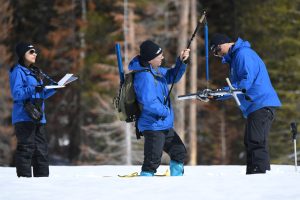
On Friday, the Department of Water Resources (DWR) conducted its third snow survey of the season at Phillips Station in the Lake Tahoe area. The manual survey recorded 116.5 inches of snow depth with a water equivalent of 41.5 inches, which is 177 percent of the average. The department’s 130 electronic sensors statewide found a snow water equivalent of 44.7 inches, or 190 percent of the average for this date.
“Thankfully, the recent storms combined with the January atmospheric rivers have contributed to an above-average snowpack that will help fill some of the state’s reservoirs and maximize groundwater recharge efforts. But the benefits vary by region, and the Northern Sierra, home to the state’s largest reservoir, Lake Shasta, is lagging behind the rest of the Sierra,” DWR Director Karla Nemeth said. “It will also take more than one good year to begin the recovery of the state’s groundwater basins.”
Currently, the state’s snowpack is close to toppling the record snow year of 1982–83, which varies considerably by region, according to DWR. The Central Sierra is at 175 percent of its April 1 average. Many rural areas are still experiencing challenges with their water supply, especially communities that rely on groundwater supplies that have been depleted due to the prolonged drought.
“While winter storms have helped the snowpack and reservoirs, groundwater basins are much slower to recover, advised DWR’s Snow Surveys and Water Supply Forecasting Unit Manager Sean de Guzman. “It takes more than a single wet year to really recover a lot of those groundwater basins that have been critically overdrafted for so many years during this drought.”
With just one month left in the wet season, DWR officials say they are providing updated runoff forecasts to water managers and closely monitoring spring runoff scenarios and river flows to ensure the most water supply benefits from this year’s snowpack while balancing the need for flood control.
“We are hopeful that we will see more cold storms to add to our snowpack for the next month and help set up a long, slow melt period into spring,” shared de Guzman.
The current reservoir levels can be viewed in the image box photos.


