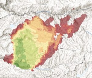
El Dorado County, CA — The Caldor Fire in El Dorado County is up to 106,562 acres after jumping over US Route 50 over the weekend.
There is five-percent containment. 17,488 structures are threatened. 345 homes have been destroyed, along with six commercial buildings. 124 smaller structures, like outbuildings, have also been destroyed.
The fire ignited on August 14th four miles south of Grizzly Flats and two miles east of Omo Ranch. 1,745 firefighters are on scene.
Click here to view the progression map.
The list of evacuation orders and warnings expanded over the weekend. The latest info is listed below.
AMADOR COUNTY -WARNINGS
• Shenandoah Road at the Amador County line west through the River Pines
community, continuing west on Shenandoah Road to Ostrom Road.
• South on Ostrom Road to Jibboom Street, West on Jibboom Street to
Fiddletown Road.
• East on Fiddletown Road to Hale Road. South on Hale Road to Shake Ridge
Road.
• East on Shake Ridge Road to Charleston Road.
• South on Charleston Road to the intersection of Charleston Road and Rams
Horn Grade.
• Due east to Highway 88 at Tiger Creek Road.
• Tiger Creek Road east to Salt Springs Reservoir Road.
• East on Salt Springs Reservoir Road to the east end of the Salt Springs
Reservoir.
• Due north from the east end of Salt Springs Reservoir to Highway 88.
• South of the El Dorado-Amador County line with a western border of
Highway 88 due south to the east end of Salt Springs Reservoir.
• Southern border of the Calaveras County line.
• Eastern border of the Alpine County line.
EL DORADO COUNTY – ORDERS
• Grizzly Flat: The areas on Grizzly Flats Road east of Kendra Way into Grizzly
• Flats Proper. The areas of Diamond Railroad Grade, Old School House,
Sweeney Road, Caldor Road, and steely Ridge.
• Grizzly Flats Road east of four corners in somerset into Grizzly Flats Proper.
• The areas of Myers Lane, Varmet Ridge Road, Rodwell Canyon Road,
Snowbird Lane, and Mehwald Lane.
• East of Sly Park Road between Highway 50 and Mormon Emigrant Trail to
Ice House Road. This includes the communities of Pacific House and Fresh
Pond.
• North of Highway 50, east of Forebay Road to Ice House Road.
• Intersection of Perry Creek and Hawk Haven, the East side of Fairplay Road
from Perry Creek South to Cedarville Road. This includes Slug Gulch, Omo
Ranch, and all roads off of Slug Gulch and Omo Ranch.
• All roads off of Omo Ranch from Cedarville Road to Hwy 88.
• The area between Highway 88 and Mormon Emigrant Trail
• South of Highway 50 from Snows Road to Ice House Road.
• Between Highway 50 and Slab Creek from Snows Road to Ice House Road.
• South of Highway 50 from Ice House Road to Silver Fork Road. This includes
the community of Kyburz.
• North of Highway 50 from Ice House Road to Silver Fork Road to include IceHouse Reservoir, Union Valley Reservoir, and Loon Lake.
• Silver Fork Road in Kyburz east to Twin Bridges.
• North and south in a line extending from Twin Bridges to the Placer County
line and south to the Amador County line.
• Areas south of Farnham Ridge Road and east of Bridgeport School Road to
the Amador County line.
EL DORADO COUNTY – WARNINGS:
• North of Slab Creek to Wentworth Springs Road between Sand Mountain
and Loon Lake.
• Mosquito Road from the bridge North to include the Community of
Swansboro.
• North of Highway 50 to Slab Creek between Smith Flat and Snows Road.
• South of Highway 50 to Pleasant Valley between Smith Flat and Snows
Road, and North of Pleasant Valley between Holm and Newtown.
• South of Pleasant Valley between Bucks Bar Road and Newtown Road, East
of Bucks Bar Road to Mt Aukum Road.
• Southwest of Bucks Bar Road to Ladies Valley Road including the community
of Outingdale, Ant Hill Road, Perry Creek Road and Sand Ridge between
Ladies Valley Road and Bucks Bar Road.
• East of Mt Aukum Road (E16) from Bucks Bar Road to Omo Ranch Road.
North of Omo Ranch Road to the intersection of Omo Ranch Road and
Fairplay Road.
• South of Omo Ranch to the El Dorado County Line between Mt Aukum Road
(E16) and Fairplay Road to include Coyoteville Road, Cedar Creek and all
tributary roads.
• From the evacuation order line in Twin Bridges east to the Echo Summit and
from Highway 50 south to the Amador and Alpine County lines and north to
the Placer County line.
• Dry Lakes Section: This section is north of Wentworth Springs Road up to
the Placer County line and the remaining section of El Dorado County south
of Placer County to Loon Lake.
EL DORADO COUNTY – ROAD CLOSURES
Highway 50 will be closed in both directions from the Sly Park Road exit to Twin
Bridges. Highway 50 will be open between Meyers and Twin Bridges for local
residents only who reside between Meyers and Twin Bridges. These residents will
be subject to providing identification and proof of residency. No traffic will be
allowed west past Twin Bridges.


