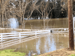
There is an Elevated Spring Flood Threat across portions of California.
The potential for flooding due to spring snowmelt in California Nevada River Forecast Center`s domain is elevated due to much above normal snowpack.
In California, this elevated risk is for many locations in the mountainous areas of the Sierra Nevada.
Some of the lower elevation regulated systems, like the San Joaquin River and its tributaries, will likely be under additional stress throughout the Spring due to higher than normal releases from the large reservoirs as they manage inflows from the above normal snowmelt volumes.
In many cases, above normal flow conditions are already being experienced due to flood control requirements to make space for the expected snowmelt. Flows are expected to remain above normal in the San Joaquin system well into the snowmelt season, putting continuous stress on the flood conveyance system.
Note that flooding in California could also result from heavy rainfall alone, or combined with snowmelt anytime during the Spring.
Everywhere from the northern portions of the Klamath basin in the Cascades down to the Tulare basin in the southern Sierra Nevada is experiencing above average snowpack. Percent of normal numbers tend to increase from north to south within the Sierra Nevada.
Precipitation totals for the current water year are much above normal to extreme for the entire state of California. The Northern Sierra 8-Station Index is on pace to break an all-time record assuming climatology for the rest of the water year.
Seasonal (April-July) Runoff Forecasts:
The seasonal runoff forecasts are very similar to the snowpack conditions. Much above normal to extreme runoff volumes can be expected during the April-July period throughout the Cascades and Sierra Nevada.
Flooding during the spring snowmelt season is definitely more probable this year due to the much above normal snowpack.
To summarize, the risk of California flooding during the snowmelt season is elevated this year for much of the Sierra Nevada. Flood conveyance systems below major reservoirs in the San Joaquin basin will be under additional stress throughout the Spring. Flooding anywhere in the state could also result from heavy rainfall, or the combination of rain and snowmelt at any time during the Spring.
Finally, the Flash Flood Watch continues for the Northern San Joaquin Valley through late Thursday night.
The Don Pedro spillway flows have ended but flood releases continue from the dam, resulting in high river levels. These elevated levels are causing flooding in the low-lying areas along the river and increasing concerns on the levees in the area.
As a precaution, the National Weather Service are encouraging local residents to be prepared to take action in the event that levee conditions were to deteriorate.
A Flash Flood Watch associated with levees means that there are conditions that could affect levee stability. If levee conditions were to deteriorate into a failure, it could lead to flash flooding and the rapid arrival of flood waters within the area protected by the levee. People in the area of the Flash Flood Watch should be prepared to quickly evacuate should a Flash Flood Warning be issued.


