Some Juneau residents urged to evacuate as Alaska’s Mendenhall Glacier releases floodwater
Some Juneau residents urged to evacuate as Alaska’s Mendenhall Glacier releases floodwater
Residents in some parts of Juneau prepared to evacuate ahead of what could be a record surge of flooding as rainwater and snowmelt in a huge basin dammed by Alaska’s Mendenhall Glacier started to flow downstream toward the capital city.
Officials in recent days have been warning people in the flood zone to be ready to evacuate. On Tuesday morning they confirmed water had started escaping the ice dam, with flooding expected into late Wednesday. They advised people in the city’s flood zone to leave.
One couple said they’re encouraging their neighbors to evacuate, but plan to stay put after sending their kids outside the flood zone. Their three daughters, aged 11, 10, and 8, were sent to a friend’s house at higher ground Tuesday to make absolutely sure they’re safe.
“The girls are having sleepovers outside the flood zone,” said Sam Hatch, a civilian Coast Guard vessel safety regulator. “A friend from work has three daughters as well so we shoved them all in one house and they’re having a six-girl epic four-day right-before-school-starts sleepover. I really owe my friend for taking them.”
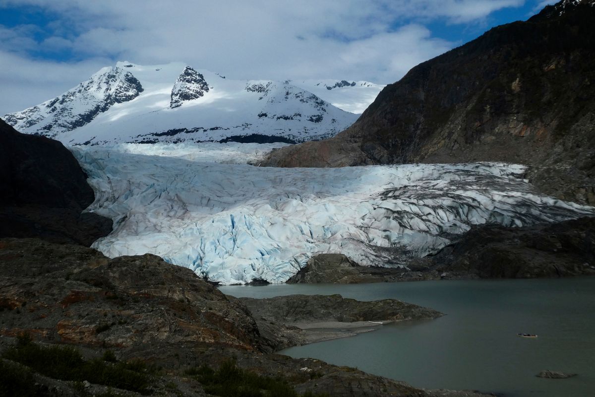
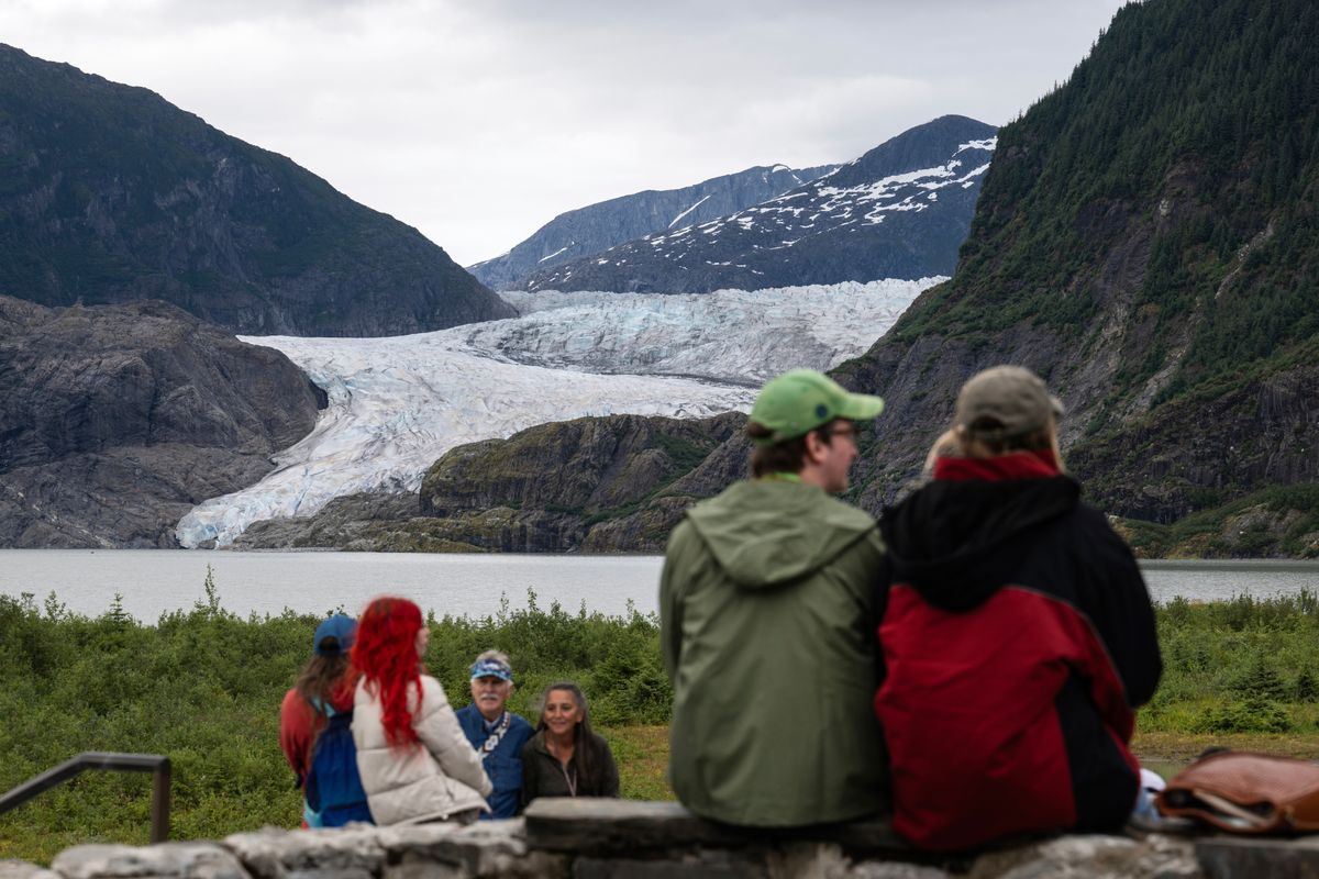
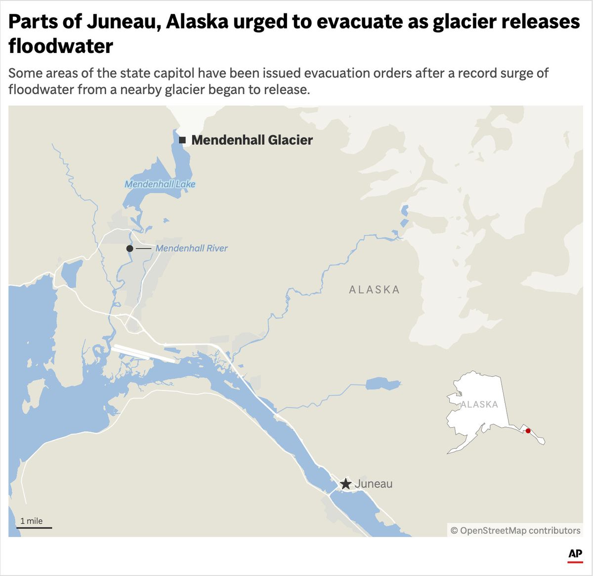
The Mendenhall Glacier is about 12 miles (19 kilometers) from Juneau, population 30,000, and is a popular tourist attraction due to its proximity to Alaska’s capital city and easy access on walking trails. Homes on the city’s outskirts are within miles of Mendenhall Lake, which sits below the glacier, and many front the Mendenhall River.
The water that’s being released in the glacial outburst is flowing into the river, putting homes that are closest to the river at risk. The National Weather Service said it expected flooding to peak at 4 p.m. local time Wednesday.
“This will be a new record, based on all of the information that we have,” Nicole Ferrin, a weather service meteorologist, told a news conference Tuesday.
Basin flooding is an annual concern
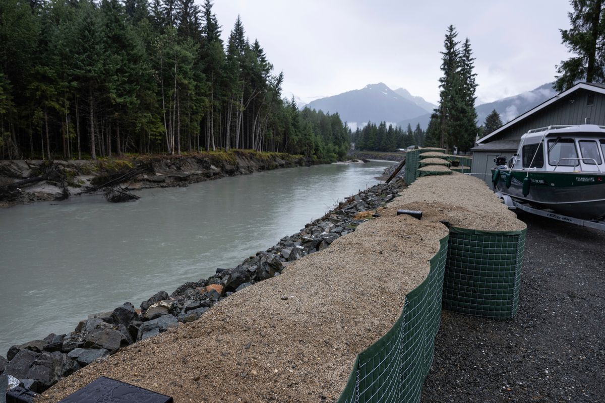
Flooding from the basin has become an annual concern since 2011, and in recent years has swept away houses and swamped hundreds of homes. Government agencies installed temporary barriers this year in hopes of protecting several hundred homes in the inundation area from widespread damage.
The flooding happens because a smaller glacier near Mendenhall Glacier retreated — a casualty of the warming climate — and left a basin that fills with rainwater and snowmelt each spring and summer. When the water creates enough pressure, it forces its way under or around the ice dam created by the Mendenhall Glacier and enters Mendenhall Lake and eventually the Mendenhall River, as it did Tuesday.
Before the basin reached the limit of its capacity and began overtopping, the water level was rising rapidly — as much as 4 feet (1.22 meters) per day during especially sunny or rainy days, according to the National Weather Service.
The city saw successive years of record flooding in 2023 and 2024, with the river last August cresting at 15.99 feet (4.9 meters), about 1 foot (0.3 meters) over the prior record set a year earlier, and flooding extending farther into the Mendenhall Valley. This year’s flooding was predicted to crest at between 16.3 and 16.8 feet (4.96 to 5.12 meters).
Last year, nearly 300 residences were damaged.
A large outburst can release some 15 billion gallons of water, according to the University of Alaska Southeast and Alaska Climate Adaptation Science Center. That’s the equivalent of nearly 23,000 Olympic-size swimming pools. During last year’s flood, the flow rate in the rushing Mendenhall River was about half that of Niagara Falls, the researchers say.
Hatch and his wife saw floodwaters lap at their floorboards in 2023, inspiring them to lift their entire house by around 3-4 feet (1 meter). Last year, their neighbors’ homes flooded by around 1 to 4 feet (0.3-1.2 meters).
A temporary levee is installed
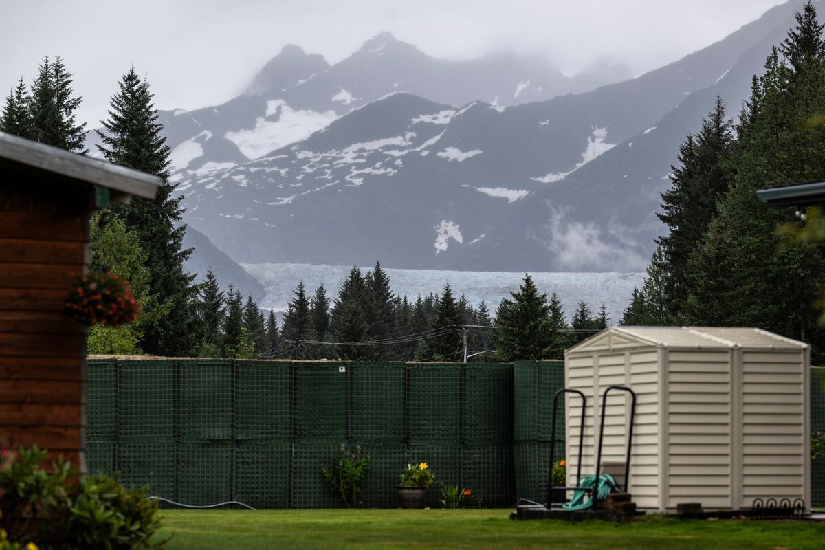
City officials responded to concerns from property owners this year by working with state, federal and tribal entities to install a temporary levee along roughly 2.5 miles (4 kilometers) of riverbank in an attempt to guard against widespread flooding. The 10,000 “Hesco” barriers are essentially giant sandbags designed to protect the neighborhoods completely during an 18-foot (5.5 meter) flood event, said emergency manager Ryan O’Shaughnessy. The barriers are intended to protect more than 460 properties.
But Hatch fears that if the water crest exceeds predictions, or somehow seeps through, it will actually make flooding at his home worse.
“If it gets around the barriers, like, upriver, and flows down, we basically become a bathtub,” Hatch said, adding that he’ll stay behind to move valuables. “My wife just bought a new mixer. So I’m not going to leave a $400 mixer downstairs, I’ll just carry it up and put it in somebody’s bedroom.”
The U.S. Army Corps of Engineers is at the start of what’s expected to be a yearslong process of studying conditions in the region and examining options for a more permanent solution such as a levee. The timeline has angered some residents, who say it’s unreasonable.
Outburst floods are expected to continue as long as the Mendenhall Glacier acts as an ice dam to seal off the basin, which could span another 25 to 60 years, according to the university and science center researchers.
___
Associated Press writer Becky Bohrer in Juneau contributed to this report.
By CEDAR ATTANASIO
Associated Press