They also thank the community for “continued resilience, cooperation, and support throughout this challenging incident.”
Update at 9:36 am: The 6-5 fire in Chinese Camp is up to 6,984 acres, an increase of 19 acres from CAL Fire’s update below. There is still no containment. The evacuation warnings issued previously remain and the evacuation orders continue for Chinese Camp Town, Six Bit Ranch Road, Six Bit Gulch Road, Red Hill Road, Don Pedro Dam Road, Old Don Pedro Dam Road, Menkee Hess Road, all roads east of Highway 108 from Junction 59 to Highway 49, both sides of Highway 120 from Chinese Camp to the Highway 120 Bridge, Rojo, and Shawmut Road. The Tuolumne County evacuation map is here.
Update at 9:16 am: Evacuation orders were downgraded this morning for the 2-7 fire northwest of Vallecito, those details are here. There were two accidents: a bulldozer that overturned as detailed here and details are still pending on the fire engine rollover crash on Highway 49.
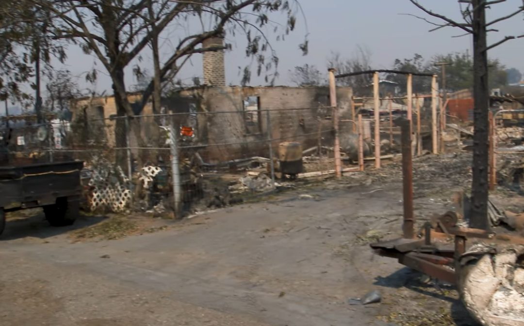
Original Post 9:08 am: CAL Fire has updated the total acreage for the TCU September Lightning Complex Fire to 13,790, a growth of 419 acres. CAL Fire details that overnight, short-range spotting and trees falling were observed by firefighters. They will work to establish and improve containment lines today on all active fires and mop-up will continue on fires that have reached containment. A list is below.
Today, CAL Fire expects increased daytime temperatures and a lack of cloud cover with Northwest winds. A Damage Inspection Team has arrived, and initial assessments are underway. Highways 108 and 4 remain open. To get to Yosemite National Park from Jamestown via Highway 120, motorists must use Jacksonville Road.
- 1-2 Fire: 15 acres 15% contained (New Hogan Lake) acreage decreased by five acres with new mapping.
- 2-2 Fire: 3,462 acres 80% contained, no growth reported since 2PM yesterday (Copperopolis, West of Dutton)
- 2-3 Fire: 294 acres 15% contained, no growth reported since 2PM yesterday (Copper Cove Ct at Obyrnes Ferry Rd, Copperopolis)
- 2-5 Fire: .1 acres 100% contained; acreage decreased by five acres with new mapping.
- 2-6 Fire: .25 acres 100% contained; acreage decreased by five acres with new mapping.
- 2-7 Fire: 599 acres 20% contained, grew by 8 acres (Vallecito)
- 2-8 Fire: 1,333 acres, up by 7 acres, 15% contained (Copperopolis, Little John Rd.)
- 4-5 Fire: 3.25 acres, 50% contained, no growth (McCormick Meadows, South of Arnold)
- 5-2 Fire: 7 acres, 100% contained (Lyons Bald Mountain Rd, Sonora) acreage decreased with new mapping.
- 6-2 Fire: 1,028 acres 15% contained, grew 77 acres (Don Pedro)
- 6-3 Fire: 1 acre 100% contained (Groveland) acreage decreased with new mapping.
- 6-5 Fire: 6,965 acres, up by 127 acres, no containment (Chinese Camp/Don Pedro)
A larger Type 1 CAL Fire Incident Management Team is managing the fires. Evacuation shelters are open at the Bret Harte High School in Altaville and at the Sonora Senior Center on Greenley Road. Animal evacuation shelters are open for livestock only at the Calaveras County Fairgrounds and for small pets at Bret Harte and the Sonora Senior Center.