Pinecrest Weather
Last updated Tue, July 14 2026 @ 03:45 pm
Pinecrest, CA
Today
4 PM
80˚
Clear
0%
5 PM
79˚
Clear
0%
6 PM
78˚
Clear
0%
7 PM
77˚
Clear
0%
8 PM
73˚
Clear
0%
9 PM
70˚
Clear
0%
Weekly Forecast
Wednesday
July 15
82˚ / 64˚
Clear
0%
Thursday
July 16
80˚ / 51˚
Clear
0%
Friday
July 17
80˚ / 51˚
Clear
0%
Saturday
July 18
81˚ / 54˚
Clear
0%
Sunday
July 19
80˚ / 56˚
Cloudy
5%
Monday
July 20
75˚ / 56˚
Clear
5%
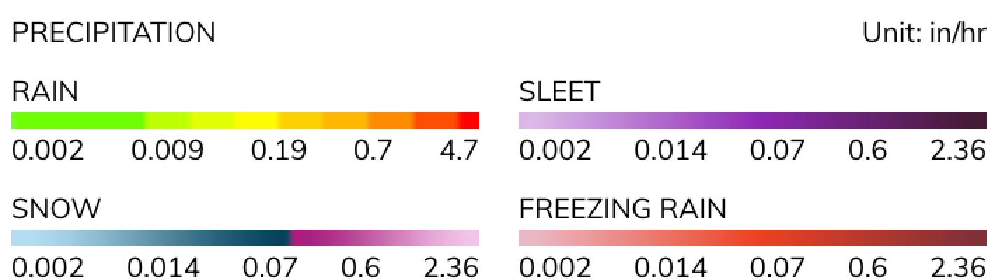
Radar


© Mapbox