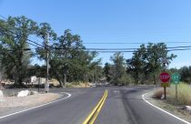
Caltrans Details Construction Timeline For Planned Highway 49 Four-Way Stop
The installation of an all-way stop at the intersection of Highway 49 and Shaws Flat Road will occur over an…
This map shows real-time local traffic conditions; green means the traffic flow is normal, orange means it is slower than normal, and red and dark red indicates slow and stopped vehicles. Updating Caltrans reports for each highway are below the map click or tap on the highway signs to jump to the road you are interested in.


Heading to Yosemite? Wondering how long the wait is at a specific entrance station?
Real-time wait information for the Big Oak Flat Entrance (Highway 120 from the west), the South Entrance (Highway 41) and Arch Rock Entrance (Highway 140) are on nps.gov under Current Wait Times.
1-way controlled traffic at the Contra Costa/San Joaquin Co Line
/at Old River Bridge/ 24 hrs a day 7 days a week thru 1900 hrs on 7/26/26
- Due to construction
No traffic restrictions are reported for this area.
No traffic restrictions are reported for this area.
1-way controlled traffic at various locations from 0.2 mi north of the
Jct of SR 41 /at Junction Dr/ to 0.4 mi north of the Jct of SR 41
/at Meadow Vista Dr/ (Madera Co) 24 hrs a day 7 days a week - Due to
emergency work
1-way controlled traffic at various locations from Laverone St to Main St
/in Plymouth/ (Amador Co) from 0600 hrs to 1700 hrs Monday thru Friday thru
7/10/26 - Due to construction
1-way controlled traffic at various locations from Bell Rd to Cosumnes River
/in Enterprise/ (Amador Co) from 0600 hrs to 1700 hrs Monday thru Friday thru
7/10/26 - Due to construction
1-way controlled traffic at various locations from 3.2 mi south of
Grass Valley to McKnight Way /in Grass Valley/ (Nevada Co) from 2100 hrs each
night to 0600 hrs each morning Monday thru Friday thru 7/10/26 - Due to
construction
Is closed to westbound traffic from 1.3 mi east of Sacramento /at Mayhew Rd/
to the Sacramento/Yolo Co Line from 0100 hrs to 0300 hrs Tuesday thru Wednesday
thru 7/8/26 - Due to construction - Motorists are advised to use an alternate
route
The westbound connector to northbound & southbound I 5 /in Sacramento/
(Sacramento Co) is closed from 2300 hrs each night to 0500 hrs each morning
Monday thru Wednesday thru 7/8/26 - Due to construction - Motorists are advised
to use an alternate route
The westbound connector to southbound SR 99 /in Sacramento/ (Sacramento Co)
is closed from 2300 hrs on 7/6/26 to 0500 hrs on 7/7/26 - Due to construction
- Motorists are advised to use an alternate route
1-way controlled traffic at various locations from 5.9 mi east of
Pollock Pines /at Bridal Veil Falls Rd/ to 5.2 mi west of Kyburz
/at Alder Creek Rd/ (El Dorado Co) from 1900 hrs each night to 0600 hrs each
morning Monday thru Saturday thru 7/11/26 - Due to constuction
No traffic restrictions are reported for this area.
No traffic restrictions are reported for this area.
A high wind advisory is in effect at the San Francisco-Oakland Bay Bridge
/in San Francisco/ (San Francisco,Alameda Co) - Travel is not recommended
for campers, trailers, or permit loads
All westbound trucks are required to stop at the brake check area
0.5 mi west of Nyack (Placer Co) - To reduced the risk of brake fires
No traffic restrictions are reported for this area.
1-way controlled traffic at Dew Drop (Amador Co) from 0700 hrs to 1600 hrs
Monday thru Friday thru 7/10/26 - Due to construction
1-way controlled traffic 1 mi east of Peddler Hill (Amador Co) from 0700 hrs
to 1600 hrs Monday thru Friday thru 7/10/26 - Due to construction
1-way controlled traffic at the Nevada State Line from 0700 hrs to 1600 hrs
Monday thru Friday thru 7/10/26 - Due to construction
Southbound traffic is reduced to 1 lane at Avenue 56 /in Earlimart/
(Tulare Co) - Due to a hazmat
A high wind advisory is in effect from the Stanislaus/San Joaquin Co Line
to the San Joaquin/Sacramento Co Line - Travel is not recommended for campers,
trailers, or permit loads
The northbound connector to westbound US 50 /in Sacramento/ (Sacramento Co)
is closed from 2300 hrs each night to 0500 hrs each morning Monday thru
Thursday thru 7/9/26 - Due to construction - Motorists are advised to use an
alternate route
1-way controlled traffic at various locations from 0.5 mi north of the
Butte/Tehama Co Line to South Ave /in Vina/ (Tehama Co) 24 hrs a day 7 days
a week - Due to maintenance
No traffic restrictions are reported for this area.
[YOSEMITE NAT'L PARK]
For Yosemite Nat'l Park road information call 209-372-0200
No traffic restrictions are reported for this area.
[YOSEMITE NAT'L PARK]For Yosenite Nat'l Park road information call 209-372-0200
Roads Info Last Updated: Tuesday, 7th of July 2026, 04:59:11 AM