Update at 4:2PM: CAL Fire updates the 2-8 fire is 499 acres in the area of Little John Rd Copperopolis. The 2-2 is 1,300 acres Highway 4 at Dutton West of Copperopolis, per incident command the evacuation orders have been lifted for all zones. The 2-3 fire is 20 acres in the area of Copper Cove Court at Obyrnes Ferry Road.
Update at 1:45: The 2-8 fire, which is burning 2 1/2 miles south of Copper Cove in Copperopolis, is now at 150 acres. Additional resources have been requested to help with this incident.
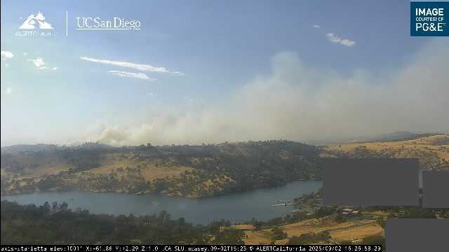
Update at 9:46 am: The “2-2 Fire” on Highway 4 near Dutton Road, west of Copperopolis, is now estimated to be 1,200 acres, according to CAL Fire. Firefighters are fully engaged in suppression efforts. Highway 4 remains closed in both directions, near the fire.
Meanwhile, the “2-3 Fire” on O’Byrnes Ferry Road near Reed Turnpike is still estimated to be 20-30 acres.
The Calaveras County Sheriff’s Office is monitoring both incidents, working with CAL Fire. The sheriff’s office reports that no evacuation advisories have been issued at this time for the fires.
Update at 8:11 am: Caltrans is closing Highway 4 near Telegraph Road due to the now 400-acre 2-2 Fire. The fire has been moving to the north toward Highway 4. Travelers will need to avoid the area.
Update at 7:05 am: There is a revised size estimate on the 2-2 Fire, which is near Highway 4 and Dutton Road (West of Copperopolis). CAL Fire’s Emily Kilgore says it is estimated to be 300 acres. Additional resources are responding.