The National Weather Service has issued a High Wind Warning for the Mother Lode and the northern San Joaquin Valley until 2 PM this afternoon. Additionally, a Wind Advisory is in effect for the Mariposa County foothills and the central San Joaquin Valley until 4 PM this afternoon.
South to southeast winds of twenty to thirty mph will continue, with gusts ranging from fifty to sixty-five mph.
Gusty and damaging winds could blow down trees, tree limbs, power lines and unsecured projects. Widespread power outages are expected.
Saturated soils will allow for trees to topple more easily during this wind event. The strongest winds will be through this morning.
Use extra caution when driving. Travel will be difficult, especially for high profile vehicles.
People should avoid being outside in forested areas and around trees and branches. If possible, remain in the lower levels of your home during the windstorm, and avoid windows. Secure outdoor objects.
A Flood Advisory is also in effect until 6 PM this evening for Tuolumne and Calaveras Counties.
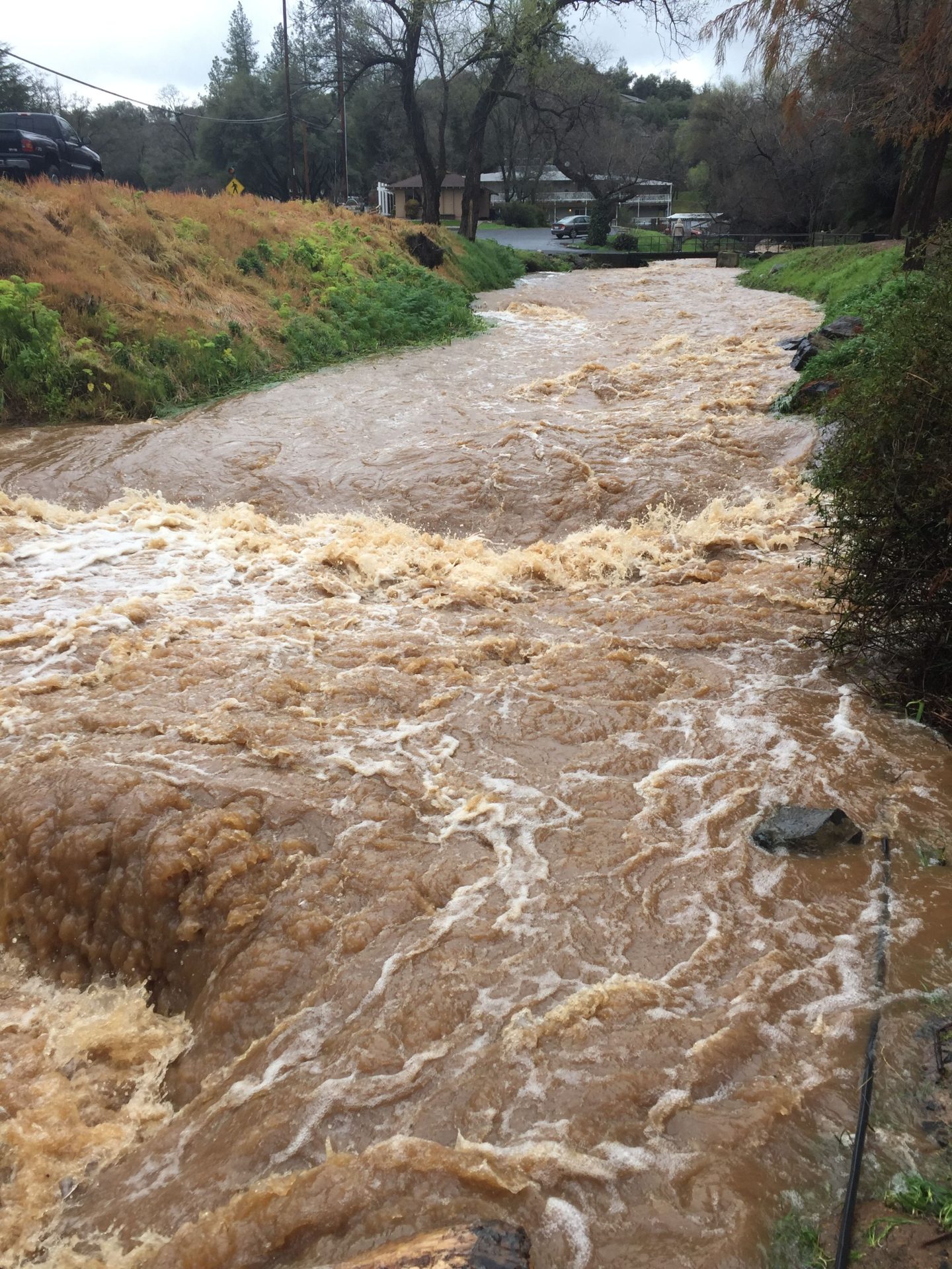
At 6:32 AM this morning, Doppler radar and automated rain gauges indicated widespread moderate to heavy rain spreading into the region.
This will cause urban and small stream flooding. There will likely be minor flooding in low-lying and poor drainage areas and water over the roadways.
Turn around, don`t drown when encountering flooded roads. Most flood deaths occur in vehicles.
Several more rounds of moderate to heavy, excessive rain are forecast across Northern California into next week which will lead to rises on area rivers, creeks and streams.
An overall Flood Watch remains is currently effect for the Mariposa County foothills, the lower Sierra Nevada of Mariposa County, Yosemite National Park and the central San Joaquin Valley until late Tuesday night. A Flood Watch is also in effect for the Mother Lode and the northern San Joaquin Valley until Wednesday afternoon.
Flooding caused by excessive rainfall and an atmospheric river, continues to be possible.
Excessive runoff may result in flooding of rivers, creeks, streams, and other low-lying and flood-prone locations. Creeks and streams may rise out of their banks. Flooding may occur in poor drainage and urban areas. Low-water crossings may be flooded. Storm drains and ditches may become clogged with debris. Extensive street flooding and flooding of creeks and rivers are possible. Area creeks and streams are running high and could flood with more heavy rain.
You should monitor later forecasts and be alert for possible Flood Warnings. Those living in areas prone to flooding should be prepared to take action should flooding develop.
Finally, a Winter Storm Warning remains in effect for the western slope of the northern Sierra Nevada, until 4 PM Tuesday. A Winter Storm Warning is also in effect for Yosemite National Park above 6,000 feet until 4 AM Wednesday.
Additional heavy snow accumulations will range from ten inches to six feet above the 5,000 foot elevation. The higher you go, the more the snow.
The snow levels have been mostly around 4,500 to 5,500 feet, but will rise this morning to 6,500 to 7,500 feet. This will lower back to around 4,500 to 5,000 feet this afternoon and evening.
Winds could gust as high as sixty to seventy mph. The strongest winds will be into early this afternoon.
Very strong winds could cause extensive tree damage.
Widespread blowing snow could significantly reduce visibility resulting in periods of near whiteout conditions. Travel could be very difficult to impossible, especially at the higher pass levels where the impacts will be greatest. If you must travel, keep an extra flashlight, food, and water in your vehicle in case of an emergency.