
Sonora, CA — A decline in precipitation deficits after the recent stormy weather in the state, according to the U.S. Drought Monitor’s weekly report.
While California remains in the grip of a yearslong drought, the latest map issued by the monitor yesterday showed some decreases in all categories of drought, including “exceptional” and “extreme,” compared to a week earlier. A year ago, those two worst categories combined covered much of the state.
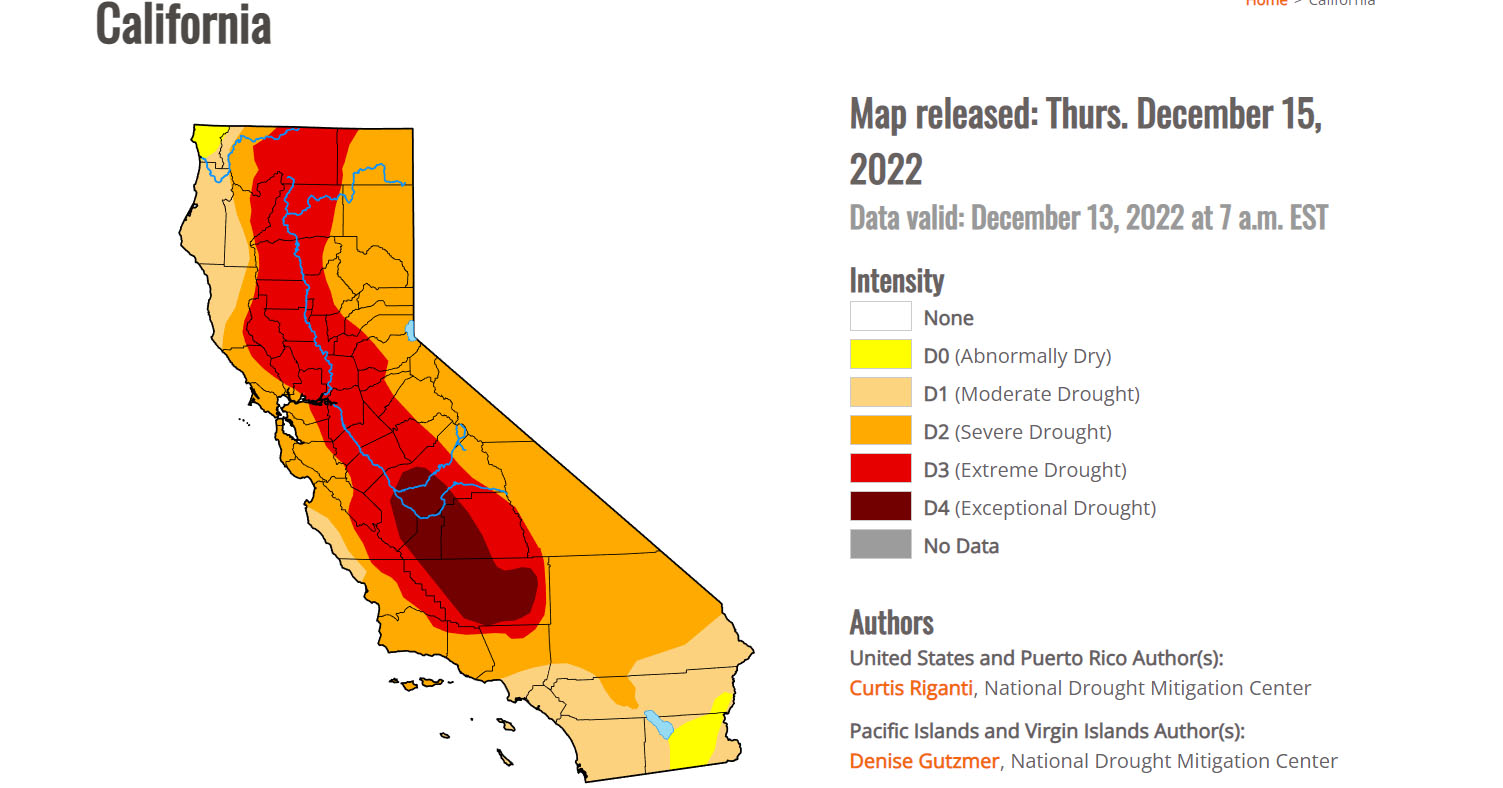
“Hefty rainfall amounts in some of the coastal mountain ranges of California caused high streamflow, which lessened precipitation deficits and led to localized improvements,” detailed the monitor report, adding, “Widespread improvements occurred in parts of the central Sierra Nevada range, where heavy snow fell and added to a healthy early-season snowpack.”
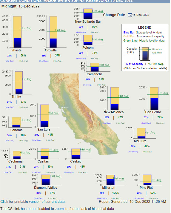
This chart shows the Department of Water Resources (DWR) current levels of the state’s reservoirs. Some of the wet weather occurred close to Tuesday morning’s data cutoff for this current report, with monitor officials stating that more data will be available for analysis next week. They caution that while the monitor’s report is modestly positive, early-season storms can abruptly give way to a dry winter, and experts say it would take multiple years of significant precipitation to overcome deficits. Further details on the state’s drought conditions can be viewed by clicking here.