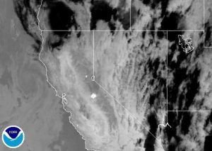
Stanislaus National Forest, CA – The Groveland Ranger District in the Stanislaus National Forest has been shut down in the area of the Rim Fire. The Forest Order is effective as defined below from August 22, 2013 until the Rim Fire is declared out.
Below is the entire order from Forest Supervisor Susan Skalaski:
Rim Fire Closure
Stanislaus National Forest
Pursuant to 16 USC 551 and 36 CFR 261 .50(a) and (b), and to provide for public safety, the following acts are prohibited within the Groveland Ranger District of the Stanislaus National Forest.
This Order is effective from August 22, 2013 until the Rim Fire is declared out.
1. Going into or being upon any National Forest System land within the Rim Fire Closure Area. The Rim Fire Closure Area boundary begins at the southeast corner of the Stanislaus National Forest boundary at its intersection with the Yosemite National Park boundary and the Merced River, then continues west along the southern edge of the forest’s congressional boundary to its intersection with the North Fork of the Merced River, then continues north along the North Fork of the Merced River to its intersection with Forest Road No. 2S05 (Greeley Hill Rd.), then continues west along Greeley Hill Road to its intersection with Smith Station Road, then continues north along Smith Station Road to its intersection with Highway 120, then continues west along Highway 120 to its intersection with the forest’s congressional boundary, then continues north and northwest along the forest congressional boundary to its intersection with Hunter Creek, then continues east along Hunter Creek to its intersection with Forest Road No. 1 N01 , then continues northwest along Forest Road No.1 N01 to its intersection with Forest Road No. 2N11, then continues northeast along Forest Road No. 2N11 to its intersection with Forest Road No.1 N04, then continues east along Forest Road No. 1 N04 to its intersection with Cotton Wood Creek, then continues southeast along Cottonwood Creek to its intersection with the Clavey River, then continues south along the Clavey River to its intersection with Reed Creek, then continues northeast along Reed Creek to its intersection with Cottonwood Road and Forest Road No. 3N01, then continues east along Cottonwood Road to its intersection with the forest boundary, then continues south and east along the forest boundary to its intersection with the southern boundary line of Sections 17 and 16 in Township 1 North Range 19 East, then continues east along the southern boundary of Sections 17 and 16 to the forest boundary, then continues southeast along the forest boundary back to the starting point, as shown on the attached map. 36 CFR 261 .53(e).
2. Being on the National Forest System roads listed below and shown on the attached map. 36 CFR 261 .54(e).
a. Any National Forest System road within the Rim Fire Closure Area.
b. Forest Road No. 1 N07 from its intersection with Forest Road No. 1 N98, then south to the Rim Fire Closure Area boundary.
Pursuant to 36 CFR 261.50(e), the following persons are exempt from this Order:
1. Persons with a permit from the Forest Service specifically authorizing the otherwise prohibited act or omission.
2. Any Federal, State, or local officer or member of an organized rescue or fire fighting force in the performance of an official duty.
These prohibitions are in addition to the general prohibitions contained in 36 CFR Part 26261 , Subpart A.
A violation of these prohibitions is punishable by a fine of not more than $5,000 for an individual or $10,000 for an organization, or imprisonment for not more than six months, or both. 16 USC 551 and 18 USC 3559, 3571, and 3581 .
Executed in Sonora, California, this 22nd day of August, 2013.
SUSAN SKALSKI
Forest Supervisor
Stanislaus National Forest


