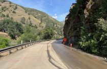
Highway 140 Back Open, But With Traffic Delays
Caltrans reports that today through Friday, pavement repairs will be ongoing in Mariposa County.
This map shows real-time local traffic conditions; green means the traffic flow is normal, orange means it is slower than normal, and red and dark red indicates slow and stopped vehicles. Updating Caltrans reports for each highway are below the map click or tap on the highway signs to jump to the road you are interested in.


Is closed from Marsh Creek Rd to Byron Highway /in Brentwood/
(Contra Costa Co) from 1930 hrs each night to 0500 hrs each morning Sunday thru
Friday thru 5/8/26 - Due to construction - Motorists are advised to use an
alternate route
Is closed from 0.6 mi west of Lake Alpine to 7.2 mi west of the
Jct of SR 89 /Ebbetts Pass/ (Alpine Co) - For the winter - Motorists are
advised to use an alternate route
Chains are required on all vehicles except 4-wheel-drive vehicles with snow
tires on all 4 wheels from Tamarack to the Mt Reba Turnoff (Alpine Co)
Please research chain control locations as Caltrans is currently working to
update chain control descriptions for consistency with internet mapping, like
Google Maps & Mapquest
1-way controlled traffic at the Contra Costa/San Joaquin Co Line
/at Old River Bridge/ 24 hrs a day 7 days a week thru 1900 hrs on 7/26/26
- Due to construction
No traffic restrictions are reported for this area.
No traffic restrictions are reported for this area.
1-way controlled traffic at various locations from 0.2 mi north of the
Jct of SR 41 /at Junction Dr/ to 0.4 mi north of the Jct of SR 41
/at Meadow Vista Dr/ (Madera Co) 24 hrs a day 7 days a week - Due to
emergency work
1-way controlled traffic at various locations from Bradley Dr to
Diamond Rd /in Diamond Springs/ (El Dorado Co) from 0700 hrs to 1700 hrs Monday
thru Friday thru 5/8/26 - Due to construction
No traffic restrictions are reported for this area.
[CAPITAL CITY FREEWAY]No traffic restrictions are reported for this area.
No traffic restrictions are reported for this area.
A high wind advisory is in effect at the San Francisco-Oakland Bay Bridge
/in San Francisco/ (San Francisco,Alameda Co) - Travel is not recommended
for campers, trailers, or permit loads
Westbound traffic is reduced to 1 lane from the Placer/Nevada Co line
to the Jct of SR 20 (Nevada Co) - Due to emergency work
There is a dense fog advisory in effect from Colfax to Cisoc (Placer Co)
- Motorists are advised to drive with caution
All westbound trucks are required to stop at the brake check area
0.5 mi west of Nyack (Placer Co) - To reduced the risk of brake fires
No traffic restrictions are reported for this area.
No traffic restrictions are reported for this area.
No traffic restrictions are reported for this area.
[IN THE NORTHERN CALIFORNIA AREA]No traffic restrictions are reported for this area.
Is closed from 26.4 mi east of Strawberry (Tuolumne Co) to 7.9 mi west of
the Jct of US 395 (Mono Co) /Sonora Pass/ - Due to adverse weather - Motorists
are advised to use an alternate route
For Yosemite Nat'l Park road information call 209-372-0200
No traffic restrictions are reported for this area.
[YOSEMITE NAT'L PARK]For Yosenite Nat'l Park road information call 209-372-0200
Roads Info Last Updated: Tuesday, 5th of May 2026, 12:59:23 PM