Blizzard Warning Issued For The Sierra Nevada
A pair of weather systems will move through the region, spreading heavy snowfall accumulations to the Sierra Nevada.
The winter storm currently moving through, should wind down by late Wednesday morning with a brief lull ahead of the much more impactful disturbance.
The trailing system arriving Wednesday evening, could produce several feet of snowfall accompanied by high winds leading to blizzard/whiteout conditions.
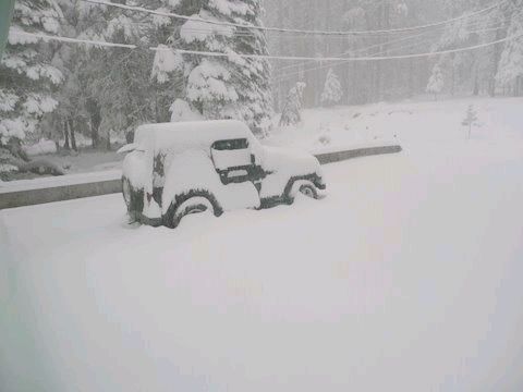
Travel will be dangerous to nearly impossible, and is strongly discouraged.
A Winter Storm Warning for the Sierra Nevada above 5,000 feet, is now in effect until 4 AM Friday.
Additionally, a rare Blizzard Warning has been issued for the Sierra Nevada above 6,500 feet, from 7 PM Wednesday through 7 AM Thursday.
Between 5,000 and 6,500 feet, total snow accumulations will range between four inches to four feet.
Above 6,500 feet, heavier snowfall is likely with total snow accumulations ranging between sixteen inches to nine feet.
Winds gusting to as high as seventy-five mph, will cause blizzard/whiteout conditions in blowing snow.
The combination of a heavy, wet snow with high winds may down power lines and trees. Be prepared for significant reductions in visibility at times.
Significant drifting of the snow is also likely. Travel will be dangerous and is not advised.
Additionally, a High Wind Watch has been issued for the Mother Lode and the Northern San Joaquin Valley, from Wednesday afternoon through late Wednesday night.
Winds of twenty-five to thirty-five mph are expected, with gusts ranging up to sixty mph.
Power outages, downed trees and difficult driving conditions are expected.
Also, a Flood Watch remains in effect for both the Mother Lode and the Northern San Joaquin Valley, from Wednesday afternoon through Thursday morning.
Rainfall amounts of one to three inches are possible in the Central Valley. Up to seven inches of rain is forecast for the Mother Lode.
Periods of heavy rain, along with the strong winds, will make driving difficult due to slippery roads and poor visibility.
There is the potential for some localized ponding of water on roadways. Rises on small streams and creeks could lead to flooding.
Finally, a Flash Flood Watch has been issued for the Sierra Nevada below 7,000 feet, from Wednesday afternoon through Thursday evening.
Heavy rain may lead to excessive runoff, rising water levels on area rivers and streams and present the threat of flash flooding.
Mud slides, rock slides and debris flows are possible in some locations, especially in the vicinity of the Ferguson burn scar.
Some roads may become closed, impassable, or washed out.
A Winter Storm Warning means there will be snow covered roads and limited visibilities. Travel is not recommended while the Warning is in effect. If you must travel, keep an extra flashlight, food and water in your vehicle in case of an emergency.
A Blizzard Warning means severe winter weather conditions are expected or occurring. Falling and blowing snow with strong winds and poor visibilities are likely. This will lead to whiteout conditions, making travel extremely dangerous. Do not travel. If you must travel, have a winter survival kit with you. If you get stranded, stay with your vehicle.
A High Wind Watch means there is the potential for a hazardous high wind event. Sustained winds of at least 40 mph, or gusts of 58 mph or stronger may occur.
A Flood Watch means there is a potential for flooding based on current forecasts. You should monitor later forecasts and be alert for possible Flood Warnings. Those living in areas prone to flooding should be prepared to take action should flooding develop.
A Flash Flood Watch means that conditions may develop that lead to flash flooding. Flash flooding is a VERY DANGEROUS SITUATION. You should monitor National Weather Forecasts and be prepared to move to a safe location should Flash Flood Warnings be issued. If you live in a flood prone area, this would be a good time to review an emergency escape plan in the event high water or a debris flow threatens your home.