Ferguson Fire Generates Groveland Ranger District Closures
Groveland, CA — Several Groveland Ranger District roads and trails are now closed through the end of September due to impacts from the Ferguson Fire.
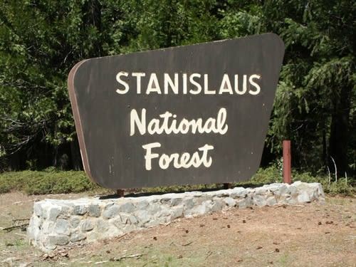
Stanislaus National Forest Supervisor Jason Kuiken issued a forest order Monday afternoon for crew and public safety as well as natural resource protection.
Officials emphasize that it is based on current and expected fire behavior and will remain in effect through Sept. 30 unless replaced or rescinded. Currently, crews and firefighters are operating heavy equipment and driving emergency vehicles in active fire areas.
Forest Order 16-2018-7 specifically identifies the closure of an area within Groveland Ranger District from Ferguson Ridge in the south to Pilot Ridge in the north. You can view an overall map in the image box.
Ignoring Posted Signs, Notices Carries Penalties
“We coordinated with the incident command staff, firefighters and emergency response agencies and determined a closure area is the best means to protect the public,” Kuiken explains. “We have installed signs and posted notices to alert the public about these temporary closures and ask everyone to remain outside the closure area until it reopens.”
Much of the Ferguson Fire is burning in steep, rugged terrain with little to no access roads. The incident, which ignited July 13 on the Sierra National Forest, is being managed under unified command between the U.S Forest Service, California Interagency Incident Management Team 4, CAL Fire and the Mariposa County Sheriff’s Office.
Going into or being found on any of the forest system land, roads or trails within the closure area without a permit from the Forest Service specifically authorizing these otherwise prohibited activities may generate a fine up to $5,000 per individual or $10,000 per organization and/or up to six months in jail.
Specific Roads, Trails, Boundary Lines
Among the closures within the boundary are nine forest roads. They are:
— 1S12 from 2S01 to its (east) terminus, near Little Nellie Falls
— 2S04 from 2S01 to its (west) terminus at Pilot Peak
— 2S84 from the forest boundary to its (west) terminus at 1S12
— 2S20 from Yosemite National Park to its (south) terminus at its second intersection with 1S12
— 2S05 and all its spur roads from 2S01 (south) to the forest boundary
–2S02, aka Bull Creek Road, from 2S05 to 2S01
— 2S03 from 2S05 to its (east) terminus at 2S02
— 2S13 from 2S01 to its (south) terminus at 2S02 in Anderson Flat
— 2S01, aka Yosemite Coulterville Road, from 2S05 to its (east) terminus at the Yosemite National Park boundary
The closure also specifically includes three trails: Forest Trail 19EV157 from Forest Road 2S01 and its terminus; 19E19 from Forest Road 2S34Y to its terminus; and 19E81, aka Jenkins Hill Trail, from Highway 140 to Forest Road 3S01.
The entire closure area boundary is described as follows: It begins at the intersection of the Stanislaus National Forest and Merced River and continues north and west along the forest boundary to where it intersects with the North Fork of the Merced River; then, north along that river fork to where it intersects with the Tuolumne-Mariposa county boundary at the intersection of Forest Road 2S04. It then continues east along Forest Road 2S01 to where it intersects with the forest boundary and that of Yosemite National Park after which it continues south along the forest and park boundary to where it intersects with the Merced River, then moving west along the river back to the starting point.
More Ferguson Fire updates are here.