Local Flood Watch Issued
A parade of strong weather systems will move through Northern California through Tuesday of next week.
Main impacts include heavy rain and heavy snow. Breezy to locally gusty winds are possible Thursday and this weekend. Heavy snow combined with wind, will likely result in hazardous mountain travel and road closures.
Downed trees and occasional power outages are likely.
Snow levels will begin Thursday at 7,000 feet before falling to 5,000 feet this weekend, and then to 3,000 feet by Monday.
Snow accumulations of several feet are expected.
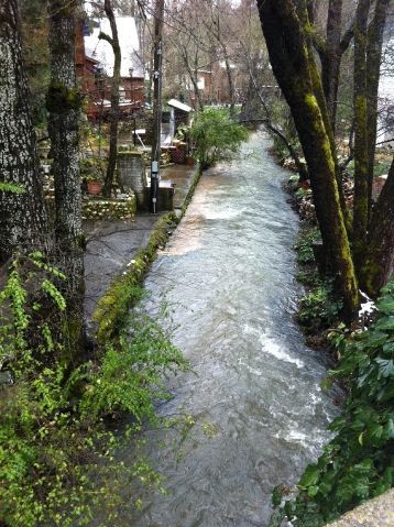
The National Weather Service has issued a Flood Watch for Calaveras and Tuolumne County below 4,000 feet from late tonight through Sunday afternoon.
The rainfall totals will be higher than last series of storms.
Saturated soils and swollen small creeks and streams from recent rains have primed the area for potential flooding with the approaching storms. These storm systems will bring the potential for widespread nuisance flooding to low lying areas, ponding of water on area roadways, and flooding of small creeks and streams. Small creeks will be running high and fast, avoid playing or working near them.
A Flood Watch means there is a potential for flooding based on current forecasts. You should monitor later forecasts and be alert for possible flood warnings. Those living in areas prone to flooding should be prepared to take action should flooding develop. Remember: Turn around, don`t drown.