Update: Larger Incident Command Team Called To Tamarack Fire
Update at 9:40am: The US Forest Service reports that the Tamarack Fire is up to 23,078 acres and there is still no containment. Some lines are being constructed that officials hope will hold the fire, but they are not strong enough yet to be considered “containment.”
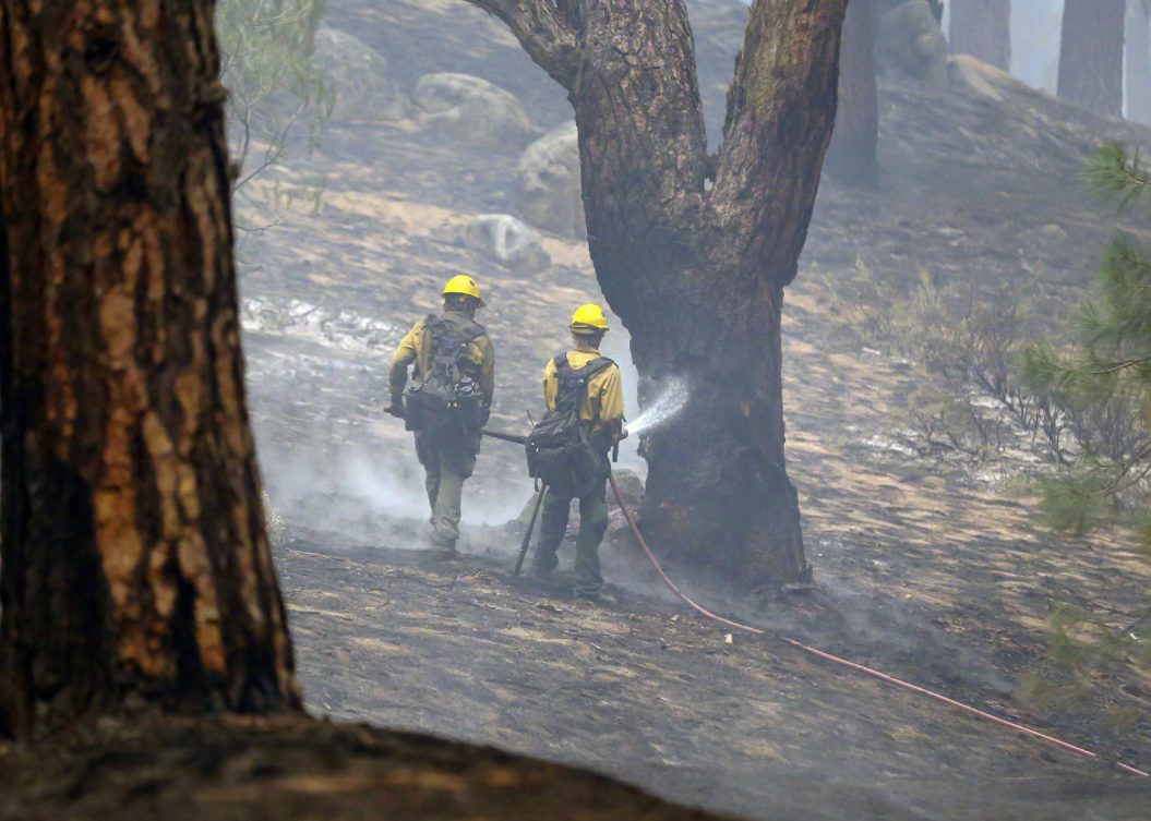
The US Forest Service adds, “Firefighters plan to continue point protection efforts around structures in all areas currently being impacted by fire. Crews will continue securing established line around Markleeville by mopping up hot spots. Last night, a firing operation was completed along a containment line being established from Highway 89 to Diamond Valley Road. Crews will continue to improve and mop up this line today. Firefighters are working to limit fire spread north towards Highway 88 and Carson Canyon. Today, as resources become available, they will begin line construction at Highway 89 moving to the southwest.”
The earlier announced road closures and evacuations remain in place.
Original story posted at 6:18am: Markleeville, CA — The size of the massive Tamarack Fire in Alpine County is somewhat unclear this morning.
On Saturday, Forest Service officials put the size at 21,000 acres. However, yesterday, the size estimate was reduced to around 18,300. Officials are hoping to do an infrared flight to gain a better estimate. A new size projection should be released later this morning. There is still no containment and nearly 800 firefighters are assigned to the incident.
A Type 3 incident management team is currently overseeing operations, but a larger Type 1 team will take over operations Tuesday morning due to the increasing complexity of the incident. They are the Rocky Mountain Team 1.
Providing an update on the latest suppression strategy, the Forest Service reports, “Firefighters worked on the west flank of the fire to protect structures by clearing brush and using other point protection tactics. They also put in line from Highway 89 east to Diamond Valley Road to slow the fire’s spread. They will continue to work to improve this line. Crews have also secured the area around Markleeville and will continue mop up tomorrow to extinguish any remaining hot spots. On the east edge of the fire, crews are working around the Carson River Ranch area and the Shay Creek and Grover Hot Springs areas, putting in containment line and extinguishing hot spots.
Closures: Highway 89 is closed at the intersection of Highway 4 and 89. Highway 4 is open west of the Highway 89 and Highway 4 junction. Please slow down and drive with caution in the area as fire crews continue to work. The Pacific Crest Trail is closed between Carson Pass (Highway 88) and Ebbetts Pass (Highway 4).
Evacuations: Markleeville, Grover Hot Springs and campground area, Shay Creek, Marklee Village, Alpine Village, Woodfords, East Fork Resort and the community of Hung A Lel Ti are under evacuation.