Sonora Elementary
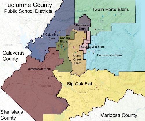
Sonora Elementary is a K-8 rural California public school district in Tuolumne County. The area is also in the Sonora Union High School District. Sonora is surrounded by the nine public elementary schools in Tuolumne County which are all separate districts except the southern Big Oak Flat School District. Jamestown District students are in the Sonora High School District. More information from Sonora Elementary School is here. Details about the town of Sonora, CA are here.
The Sonora Elementary school district boundary includes all the homes within the City of Sonora’s boundary and several neighborhoods beyond the City. The Jamestown Elementary school district is to the west, and most of the homes and properties bordering New Melones are in the northern Columbia School District. To the northeast the Sonora district includes the homes off Lyons Bald Mountain Road which is usually the first to need snow routes or that route canceled due to ice and it borders the smallest district the Belleview Elementary district. To the west of the Sonora District is Curtis Creek and to the South is Big Oak Flat.
Notable Sonora District Boundaries
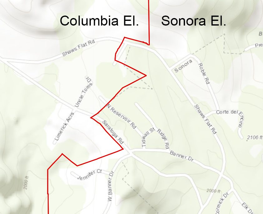 North of the city of Sonora the Columbia/Sonora District boundary cuts through Saratoga Acres following the City of Sonora Boundry.
Around Highway 49, Browns Flat is in the Sonora District, but Shaws Flat, Mormon Creek, and homes off of Parrotts Ferry Road and Sawmill Flat Road are in the Columbia district.
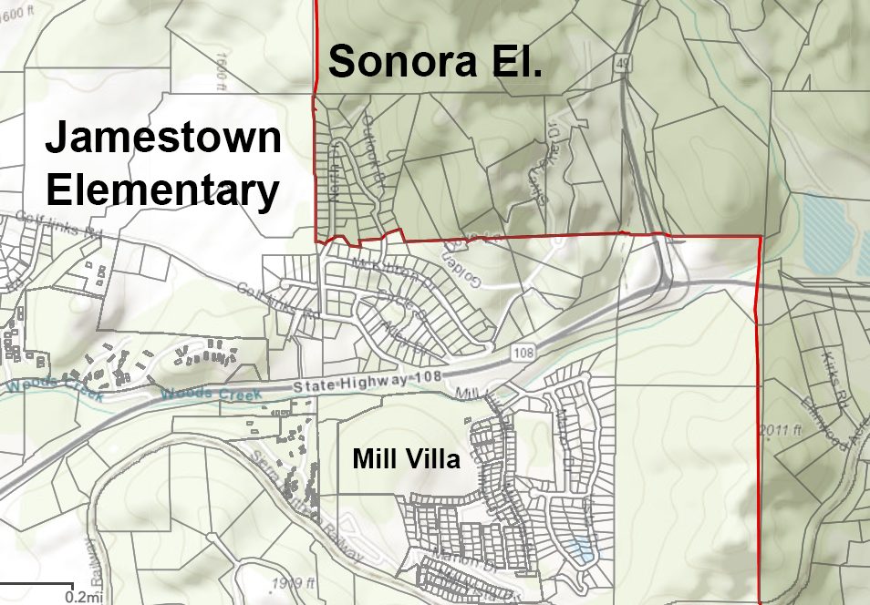 Off Golf Links Road only the homes away from Highway 108 off North Drive, Martha Lane and Outlook Drive are in the Sonora Elementary School District, the rest in that area are in Jamestown. Across HWY 108 all of Mill Villa is in Jamestown District.
Most of the homes off Campo Seco near Lime Kiln Road are in the Sonora District. The large farmland parcels off Campo Seco Road are in the Jamestown District and everything west from there up to the western border of Tuolumne County is also the Jamestown District although it is very sparsely populated with many parcels averaging 640 acres.
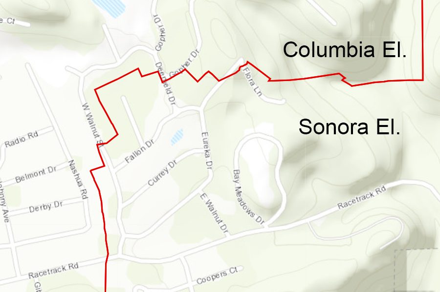 The Sonora El boundary goes up Racetrack Road but only to West Walnut Street, half of Gopher Drive is officially in Columbia El. The half of West Walnut Street toward Racetrack Road is in Sonora El with Quail Hollow Court, East Walnut Drive and Eureka Drive. All the homes off of Leland Drive are Sonora El but only the homes further away from Racetrack road are in Sonora El, the homes off Gibbs Drive near Racetrack Road are Columbia El. The homes off Rough and Ready Trail are in Columbia El.
Fir Drive off of Mono Way at the Wendy’s is as far east as the Sonora busses go, homes at the very end of Cabezut Road well past Quail Hollow and the Sylva Lane housing development area are in the Curtis Creek District. At the end of Terrace Drive on the other side of Sullivan Creek from Mono Way a few homes are included in the Sonora Boundary.
Algerine Road at Curtis Creek and the Algerine area is in the southern section of the Sonora District bordering the Big Oak Flat District. The rest of Algerine towards Wards Ferry at about the Rough and Ready Creek is in the Curtis Creek District.
The homes off Lime Kiln Road are in the Sonora District. Everything off Wards Ferry Road past Lambert Lake Road is in the Curtis Creek District.
The group of homes off Jacksonville Road on the map labeled as the old gold mining towns of Quartz, Stent, Chinese Camp and Montezuma are in the Jamestown District. The rest of the homes off Jacksonville home are south of the Sonora District in the Big Oak Flat District.